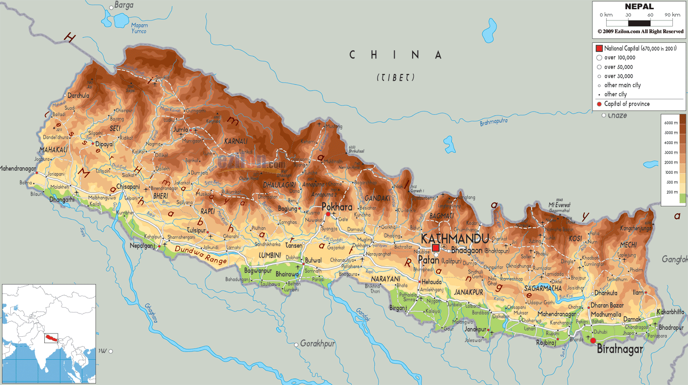
Description: The Physical Map of Nepal showing major geographical features like elevations, mountain ranges, deserts, lakes, plateaus, peninsulas, rivers, plains, landforms and other topographic features.
This map of Nepal with mountains, hills, lakes, rivers and other terrains is already large enough to read directly on your desktop. To see a full-screen zoom view on a phone or tablet, tap the map image (or tap the Zoom Map label above the image). Scan by shading provinces in various colored blocks, with Nepal's mountains, hills, lakes and rivers in bold.
 Nepal
Detailed Physical map of Nepal showing the Himalayan Mountains (including Mount Everest) and valleys, elevations and other topographic features. Nepal's physical landscape is shaped by its neighbors China to the north and India to the south. It
is 200 kilometres wideand 800 kilometres long and is of
trapezoidal shape. Uttar Pradesh, Sikkim, Uttarakhand,
Bihar, West Bengal are the Indian states which borders
Nepal.
Nepal
Detailed Physical map of Nepal showing the Himalayan Mountains (including Mount Everest) and valleys, elevations and other topographic features. Nepal's physical landscape is shaped by its neighbors China to the north and India to the south. It
is 200 kilometres wideand 800 kilometres long and is of
trapezoidal shape. Uttar Pradesh, Sikkim, Uttarakhand,
Bihar, West Bengal are the Indian states which borders
Nepal.
Siliguri Corridor separates Nepal from Bangladesh.
Out of the ten world’s tallest mountains eight are
located in Nepal. Mount Everest, at 8,848 metres called
Sagarmathais is the world’s highest or tallest mountain.
More than 240 peaks of Nepal are higher than 6,096
metres. The country is divided into three geographical
areas- hill, terai and mountain.
These features are interrupted by the major river
systems which run from north to south. The Narayani, the
Karnali and the Kosi are the main Himalayan Rivers.
Shiwalik is the outer most range of the Himalayas. The
southernmost part of this region is the Mahabharat Range
which ranges between 1,500 to 3,000 metres.
Kanchenjunga, Dhaulagiri, Cho Oyu, Lhotse, Makalu and
Manaslu are the peaks which are higher than 8,000 metres.
It is very famous for mountaineering as the side of the
mountain in Nepal is very easy to climb.

Political Map of Nepal
Political map and map image of Nepal.

Road Map of Nepal
Road map and map image of Nepal.

Regional Directory of United States of America
Information and guide about United States of America and websites with American topics.

Regional Directory of Europe
Information and guide about Europe and websites with European topics.

Regional Directory of Australia
Information and guide about Australia and websites with Australian topics.
