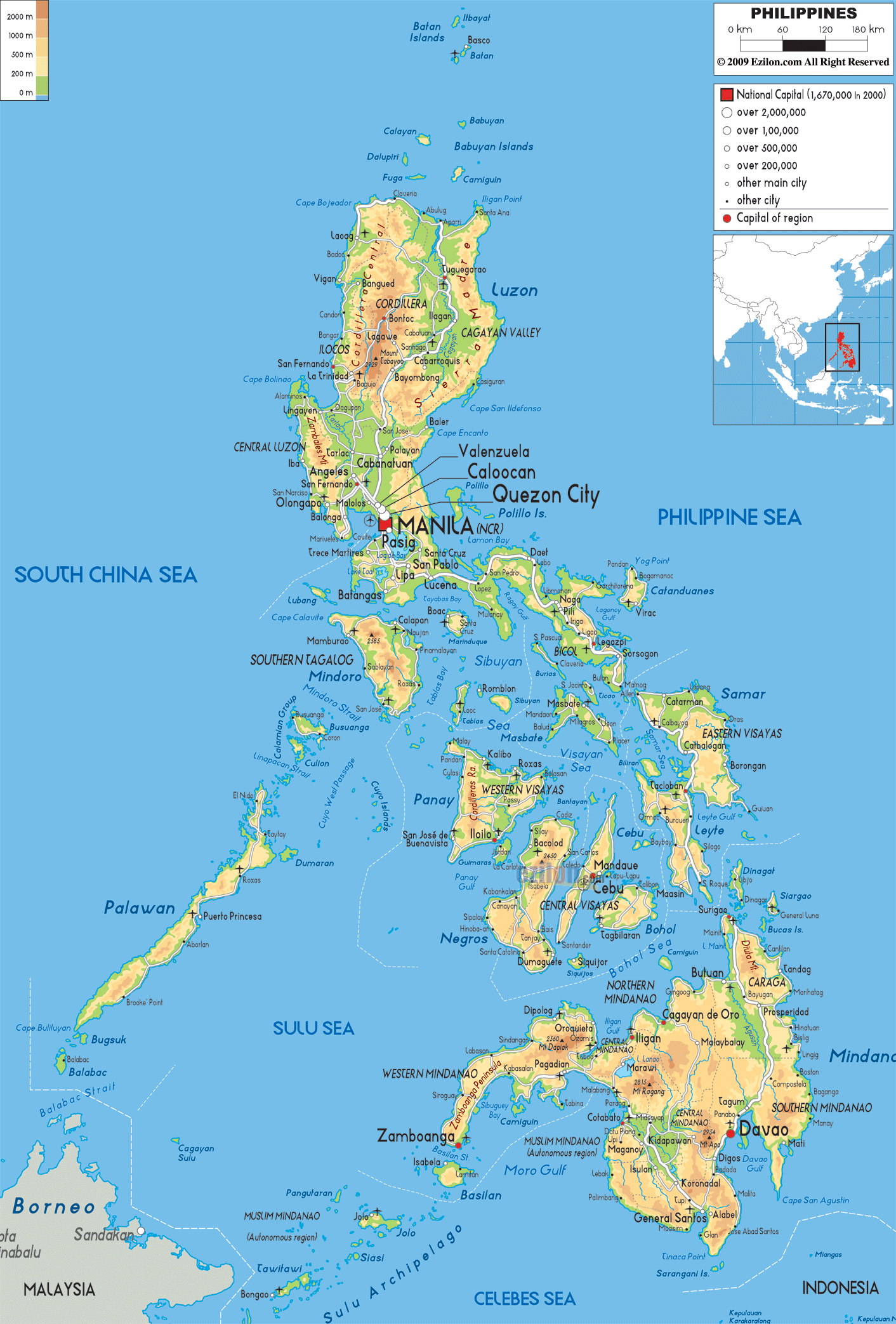
Description: The Physical Map of Philippines showing major geographical features like elevations, mountain ranges, seas, lakes, plateaus, peninsulas, rivers, plains, landforms and other topographic features.
This map of Philippines with mountains, hills, lakes, rivers and other terrains is already large enough to read directly on your desktop. To see a full-screen zoom view on a phone or tablet, tap the map image (or tap the Zoom Map label above the image). Scan by shading provinces in various colored blocks, with Philippines's mountains, hills, lakes and rivers in bold.
 In
Detailed Physical map of Philippines showing volcanoes, islands and coastline, elevations and other topographic features. The Philippines is an archipelago near Taiwan to the north, and Malaysia and Indonesia to the south across the sea. 7,107 islands constitutes together are
called Philippines.
In
Detailed Physical map of Philippines showing volcanoes, islands and coastline, elevations and other topographic features. The Philippines is an archipelago near Taiwan to the north, and Malaysia and Indonesia to the south across the sea. 7,107 islands constitutes together are
called Philippines.
Visayas, Mindanao and Luzon are the three main topographical features of the Philippines. 300,000 square kilometres is the total area of Philippines. Taiwan lies to the north of the Philippines and across the Luzon Strait. In the west across the South China Sea lies the Vietnam. The Philippine Sea surrounds it from the east. Palau is also located on the east side of the country.
It is situated on the Pacific Ring of Fire and hence it
is prone to typhoons and earthquakes. It ranks 64th in
the world in terms of area.
36,289 kilometers is the length of it coastline. It is
the 5th longest coastline in the world. Mount Apo is the
highest point in Philippines. Almost all the mountains
are of volcanic origin and are covered by tropical
rainforest.
The deepest point is The Galathea Depth in the
Philippine Trench. The Cagayan River is the longest
river. Mount Pinatubo, Taal Volcano and Mayon Volcano
are some of the many active volcanoes in the country.
Laguna de Ba is the largest lake.

Political Map of Philippines
Political map and map image of Philippines.

Road Map of Philippines
Road map and map image of Philippines.

Regional Directory of United States of America
Information and guide about United States of America and websites with American topics.

Regional Directory of Europe
Information and guide about Europe and websites with European topics.

Regional Directory of Australia
Information and guide about Australia and websites with Australian topics.
