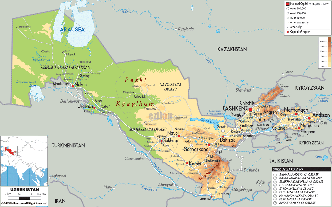
Description: The Physical Map of Uzbekistan showing major geographical features like elevations, mountain ranges, deserts, seas, lakes, plateaus, peninsulas, rivers, plains, landforms and other topographic features.
This map of Uzbekistan with mountains, hills, lakes, rivers and other terrains is already large enough to read directly on your desktop. To see a full-screen zoom view on a phone or tablet, tap the map image (or tap the Zoom Map label above the image). Scan by shading regions in various colored blocks, with Uzbekistan's mountains, hills, lakes and rivers in bold.
 Uzbekistan
is country situated in the Central part of the Asian
continent. It is one of the two doubly landlocked
countries in the world. The country spans over an area
measuring 447000 square kilometres. The country has no
direct connection to an ocean however inland manmade
canals and the Caspian Sea make it possible.
Uzbekistan
is country situated in the Central part of the Asian
continent. It is one of the two doubly landlocked
countries in the world. The country spans over an area
measuring 447000 square kilometres. The country has no
direct connection to an ocean however inland manmade
canals and the Caspian Sea make it possible.
80% of the area covered by the country is taken up by
the flat deserts. The east is full of mountain ranges
which rise to heights of nearly 4500 metres. The
foothills of the Tian Shan mountain range cover up the
south-eastern part of the country.
The Fergana Valley is the most arable part of the country which stretches for 21440 square kilometres. The valley is surrounded by various mountain ranges on the north, east and south sides. The western end is dominated by the Syr Darya River.
The Syr Darya and Amu Darya are the most important
rivers in the country. Sarygamysh Lake is a shallow lake
which lies near the country’s international border. The
Adelunga Toghi Mountain is the highest peak in the
country and it stands tall at 4301 meters above sea
level.

Political Map of Uzbekistan
Political map and map image of Uzbekistan.

Road Map of Uzbekistan
Road map and map image of Uzbekistan.

Regional Directory of United States of America
Information and guide about United States of America and websites with American topics.

Regional Directory of Europe
Information and guide about Europe and websites with European topics.

Regional Directory of Australia
Information and guide about Australia and websites with Australian topics.