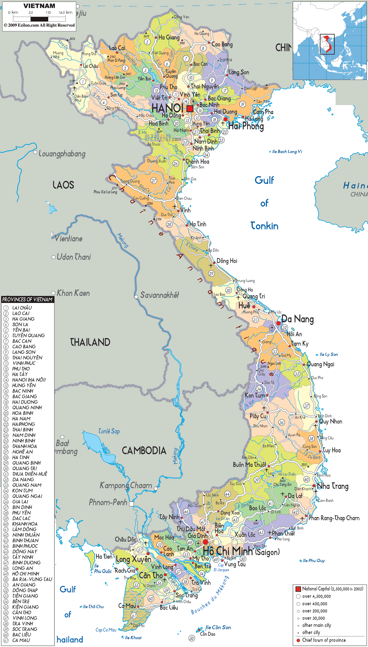

Description: Detailed large political map of Vietnam showing names of capital city, towns, states, provinces and boundaries with neighbouring countries.
 The
Socialist Republic of Vietnam or Vietnam as it is
commonly referred to as, is located in Southeast Asia.
It is the easternmost nation on the Indochina Peninsula.
On its east it is bordered by the South China Sea, on
its southwest it is bordered by Cambodia, on its
northwest it shares border with Laos and it has China on
its north. With a population of about eighty-six million
people, Vietnam is considered to be the 13th most
populated nation in the world. There are fifty-eight
provinces in the country and these provinces are further
divided in to townships, counties and provincial
municipalities.
Vietnam has an area of about 331,688 square kilometers
and its size can be compared to the size of Germany. The
country is covered 40% by mountains and it only has 20%
level land. Phong Nha-Ke Bang National Park and Halong
Bay are the two natural heritage sites of the world.
Vietnam is also home to the six biosphere reserves of
the world and these reserves are Western Nghe An, Red
River Delta, Kien Giang, Cat Ba, Cat Tien and the Can
Gio Mangrove Forest. It is being estimated that the
population of the country is about eighty-four million.

Physical Map of Vietnam
Physical map and map image of Vietnam.

Road Map of Vietnam
Road map and map image of Vietnam.

Regional Directory of United States of America
Information and guide about United States of America and websites with American topics.

Regional Directory of Europe
Information and guide about Europe and websites with European topics.

Regional Directory of Australia
Information and guide about Australia and websites with Australian topics.