Description: Detailed clear large road map of Liechtenstein with road routes from cities to towns, road intersections and exit points to neighouring countries.
This map of Liechtenstein with highways, expressways, and roads is already large enough to read directly on your desktop. To see a full-screen zoom view on a phone or tablet, tap the map image (or tap the Zoom Map label above the image). Scan by shading municipalities in various colored blocks, with Liechtenstein's highways and expressways in bold.
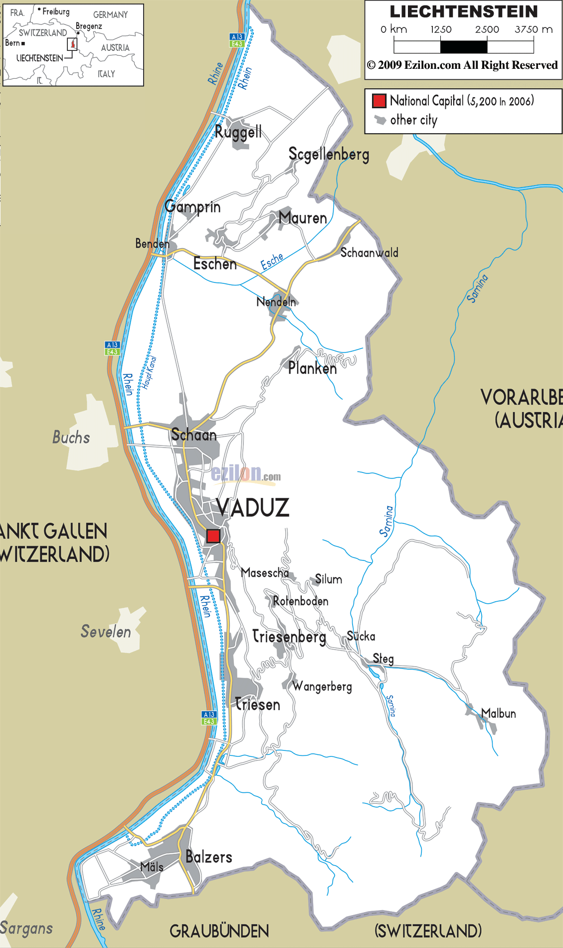
 A13 E43 is a very long motorway and road in the west end of Liechtenstein, connects from top North in the Switzerland border downwards to the Southern part of the country running parallel to River Rhein.
The road has an intersection in the North that connects to the commune or the municipality of Ruggel and Scgellenberg. Another road intersection connects A13 E43 motorway with Benden, Gamprin, Eschen, Mauren, Nendeln up to Schaanwald in the East border with Austria.
2 Road intersections connects the motorway to Schaan which have numerous roads leading to Vaduz in the central part of the country. There are also roads connecting Vaduz with Triesenberg and Triesen commune.
Roads also extend to villages of Masescha, Silum, Rotenboden, Sücka and Steg. The motorway also connects to Balzers the southern municipality near the border with Switzerland in the south.

Physical Map of Liechtenstein
Physical map and map image of Liechtenstein.

Political Map of Liechtenstein
Political map and map image of Liechtenstein.

Regional Directory of United States of America
Information and guide about United States of America and websites with American topics.

Regional Directory of Europe
Information and guide about Europe and websites with European topics.

Regional Directory of Australia
Information and guide about Australia and websites with Australian topics.