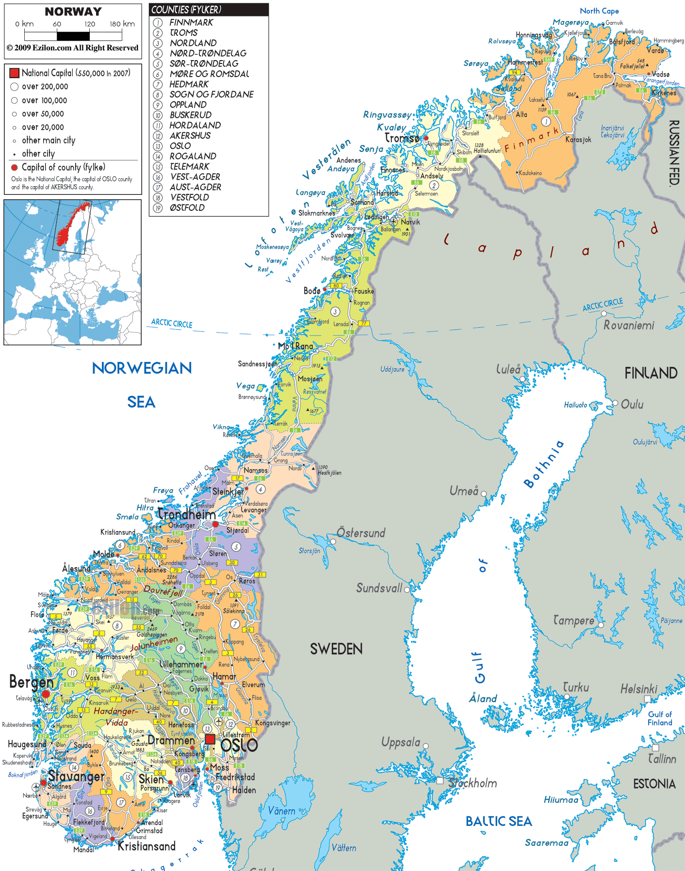
Description: Detailed large political map of Norway showing names of capital cities, towns, counties, provinces and boundaries with neighbouring countries.
 Norway
is a nation in the Western Europe and it is located on
the western part of the Scandinavian Peninsula. The
widespread coastline of this country is the home of the
very popular fjords. Norway ranks 3rd as the country
with the highest Gross Domestic Product (PPP) in the
world and it also have the second highest Gross Domestic
product per capita.
Norway
is a nation in the Western Europe and it is located on
the western part of the Scandinavian Peninsula. The
widespread coastline of this country is the home of the
very popular fjords. Norway ranks 3rd as the country
with the highest Gross Domestic Product (PPP) in the
world and it also have the second highest Gross Domestic
product per capita.
The economy of the nation is a mixed economy, where many sectors are owned by the state and it also has a combination of free market activity. As compared to the United States, the standard of living of this nation is about 30% higher. It is believed that the standard of living in this country is one of the highest in the world.
Almost all the people in Norway are a part of the State Church. The native language of the country is Norwegian but English is also taught in the schools. In fact, many people in Norway also speak English. It is basically the main foreign language in this nation.
Norway is considered to be one of the riches countries in the world because it has a very large capital reserve. The petroleum industry is an important sector of the country because it constitutes about 25% of the GDP of the country.

Physical Map of Norway
Physical map and map image of Norway.

Road Map of Norway
Road map and map image of Norway.

Regional Directory of United States of America
Information and guide about United States of America and websites with American topics.

Regional Directory of Europe
Information and guide about Europe and websites with European topics.

Regional Directory of Australia
Information and guide about Australia and websites with Australian topics.