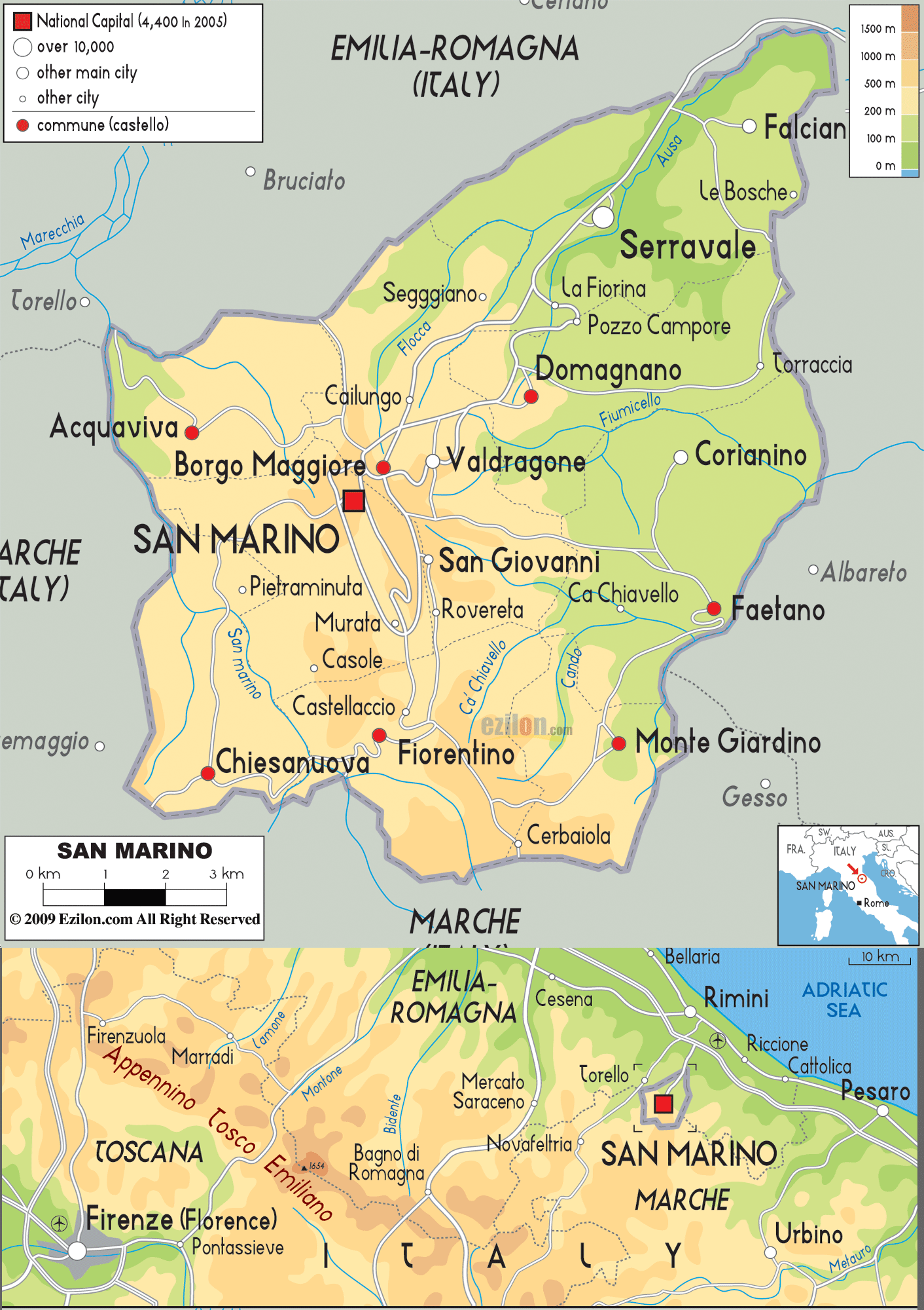
Description: The physical map of San Marino showing major geographical features like elevations, mountain ranges, seas, lakes, plateaus, peninsulas, rivers, plains, landforms and other topographic features.
 San
Marino is the third smallest country in Europe located
completely within Italy. It is located in the Apennine
Mountains. It lies between north latitude 43.94 degrees
and east longitude 12.46 degrees.
San
Marino is the third smallest country in Europe located
completely within Italy. It is located in the Apennine
Mountains. It lies between north latitude 43.94 degrees
and east longitude 12.46 degrees.
The total area covered by the country is 61.2 square
kilometers. The complete country is mountainous of which
only 17% is suited for agriculture.
The country has several rivers of which the largest is
Ausa. Other important rivers are Marano and San Marino
Rivers. The area has an abundance of trees like Oaks,
Beeches, Yews, Pines, etc. owing to the Mediterranean
climate.
The highest point of the country comes obviously from
the Apennine Mountains in the form of Mount Titano which
has 3 peaks the highest of which is in San Marino at a
height of 739 meters above sea level. The lowest point
however lies 55 meters below the surface of the Asua
River.
The Ausa River runs down from the northeast and breaks
into three tributaries of which the Flocca is the
longest. The Fiumicello River waters the east while the
Cando and Ca’ Chiavello water the southeast. Most of the
country’s rivers either come in from Italy or go into
Italy. The country experiences warm summers and pleasant
winters.

Political Map of San Marino
Political map and map image of San Marino.

Road Map of San Marino
Road map and map image of San Marino.

Regional Directory of United States of America
Information and guide about United States of America and websites with American topics.

Regional Directory of Europe
Information and guide about Europe and websites with European topics.

Regional Directory of Australia
Information and guide about Australia and websites with Australian topics.