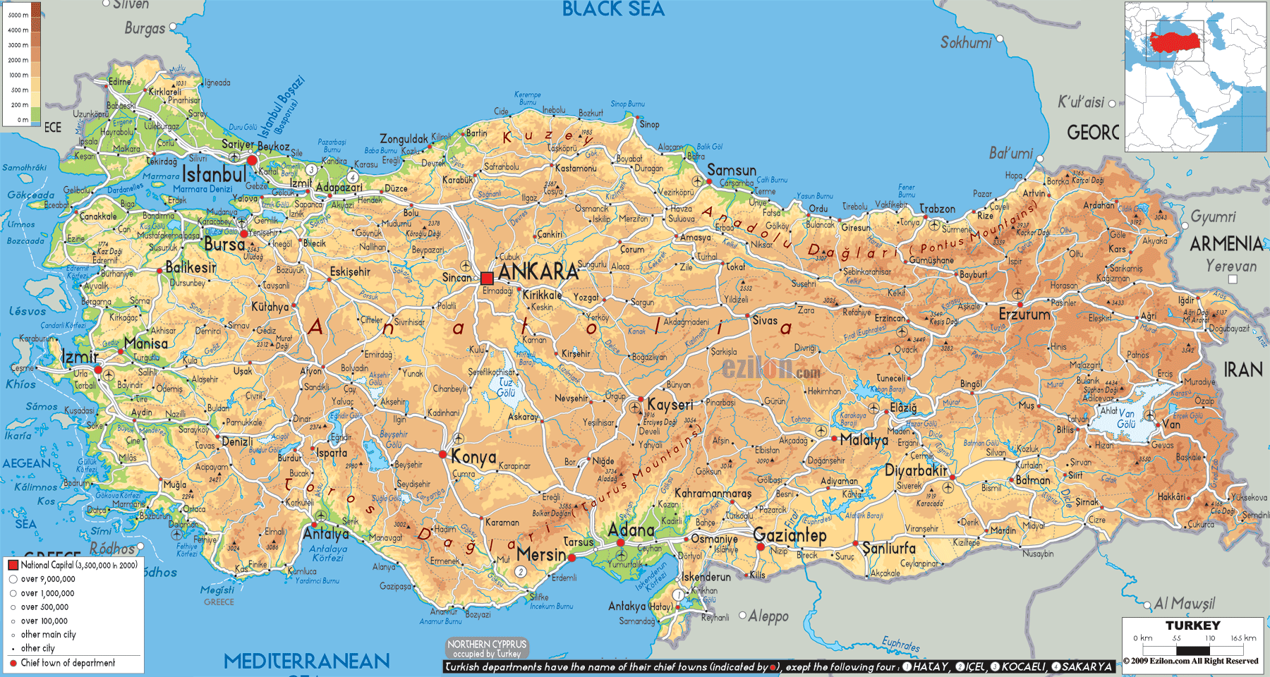
Description: The physical map of Turkey showing major geographical features like elevations, mountain ranges, seas, lakes, plateaus, peninsulas, rivers, plains, landforms and other topographic features.
This map of Turkey with mountains, hills, lakes, rivers and other terrains is already large enough to read directly on your desktop. To see a full-screen zoom view on a phone or tablet, tap the map image (or tap the Zoom Map label above the image). Scan by shading provinces in various colored blocks, with Turkey's mountains, hills, lakes and rivers in bold.
 Detailed Physical map of Turkey showing taurus and pontic mountains, the anatolian plateau and coastlines (aegean, mediterranean, black sea), elevations and other topographic features. Turkey is known officially as the Republic of Turkey. Turkey’s
lager part is in West Asia and the smaller part in south
Eastern Europe. Eight countries share border with
Turkey. They are Georgia to the northeast, Bulgaria to
the northwest, Armenia, Iran and the Azerbaijan to the
east, Greece to the west and Iraq and Syria to the
southeast.
Detailed Physical map of Turkey showing taurus and pontic mountains, the anatolian plateau and coastlines (aegean, mediterranean, black sea), elevations and other topographic features. Turkey is known officially as the Republic of Turkey. Turkey’s
lager part is in West Asia and the smaller part in south
Eastern Europe. Eight countries share border with
Turkey. They are Georgia to the northeast, Bulgaria to
the northwest, Armenia, Iran and the Azerbaijan to the
east, Greece to the west and Iraq and Syria to the
southeast.
Turkey is surrounded by the Aegean Sea to the west, the
Black Sea to the north, and the Mediterranean Sea to the
south. Turkey's area is 783,562 square kilometres.
Mount Ararat is the highest mountain and Lake Van is the
largest lake in turkey. Aegean, Marmara, Eastern
Anatolia,Black Sea, South-eastern Anatolia, Central
Anatolia, and the Mediterranean are the seven regions in
which turkey is divided. The Turkish Straits of the
Dardanelles, the Bosporus and The Sea of Marmara
separate Europe from Asia.
It has a roughly rectangular shape. The varied
landscapes of turkey are the result of complicated earth
movements. Frequent earthquakes and volcanic eruptions
feature the region of turkey.
The part of the country which is in Asia is mainly a
high plateau with coastlines which are narrower. The
country’s eastern part is very much mountainous and the
rivers like Aras, Tigris and Euphrates comes from these
mountain ranges.

Political Map of Turkey
Political map and map image of Turkey.

Road Map of Turkey
Road map and map image of Turkey.

Regional Directory of United States of America
Information and guide about United States of America and websites with American topics.

Regional Directory of Europe
Information and guide about Europe and websites with European topics.

Regional Directory of Australia
Information and guide about Australia and websites with Australian topics.
