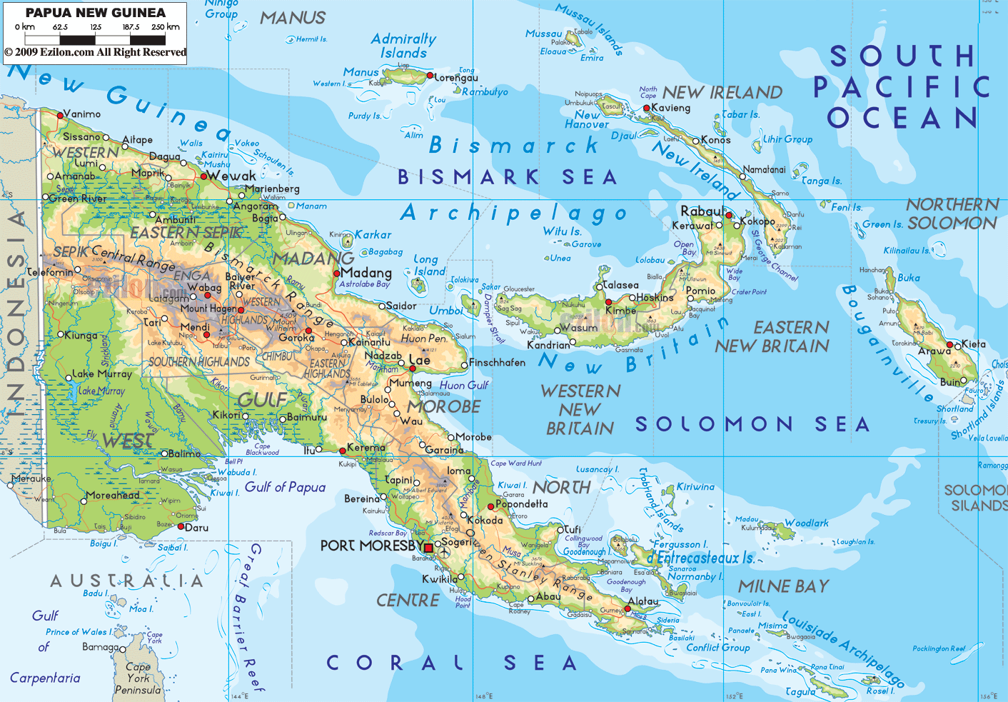
Description: The Physical Map of Papua New Guinea showing major geographical features like elevations, mountain ranges, deserts, ocean, lakes, plateaus, peninsulas, rivers, plains, landforms and other topographic features.
This map of Papua New Guinea with mountains, hills, lakes, rivers and other terrains is already large enough to read directly on your desktop. To see a full-screen zoom view on a phone or tablet, tap the map image (or tap the Zoom Map label above the image). Scan by shading provinces in various colored blocks, with Papua New Guinea's mountains, hills, lakes and rivers in bold.
 Detailed Physical map of Papua New Guinea showing mountains (the New Guinea Highlands), rainforest and coastline, elevations and other topographic features. Papua New Guinea shares the island of New Guinea with Indonesia, and lies near Solomon Islands and Australia across the Coral Sea.
The group lies at the western end of the Pacific Ocean.
The islands lie between 9.5 degrees south latitude and
147.1 degrees east longitude.
Detailed Physical map of Papua New Guinea showing mountains (the New Guinea Highlands), rainforest and coastline, elevations and other topographic features. Papua New Guinea shares the island of New Guinea with Indonesia, and lies near Solomon Islands and Australia across the Coral Sea.
The group lies at the western end of the Pacific Ocean.
The islands lie between 9.5 degrees south latitude and
147.1 degrees east longitude.
The islands are mostly mountainous with many tropical
forests on the windward side. The other ecological area
is known as the New Guinea Highlands which run along the
length of the country. The highest peaks receive
snowfall all year round. Mount Wilhelm is the highest
natural peak in the country and measures up at 4,509
meters above sea level.
The island country also has a few important rivers like
the Sepik and Fly. The Sepik is the longest river as it
flows for 1,126 kilometers. The Fly River drains and
forms the largest swamplands in the world.
The notable mountain range in the country is known as
the Finisterre Range which lies on the Huon Peninsula.
The country covers an area of 462,840 square kilometers
out of which 452,860 square kilometers is land and 9,980
square kilometers is covered by water bodies. The
coastline shared by the country measure in at 5,152
kilometers.

Political Map of Papua New Guinea
Political map and map image of Papua New Guinea.

Regional Directory of Australia
Information and guide about Australia and website listing.

Regional Directory of United States of America
Information and guide about United States of America and websites with American topics.

Regional Directory of Europe
Information and guide about Europe and websites with European topics.

Regional Directory of Australia
Information and guide about Australia and websites with Australian topics.
