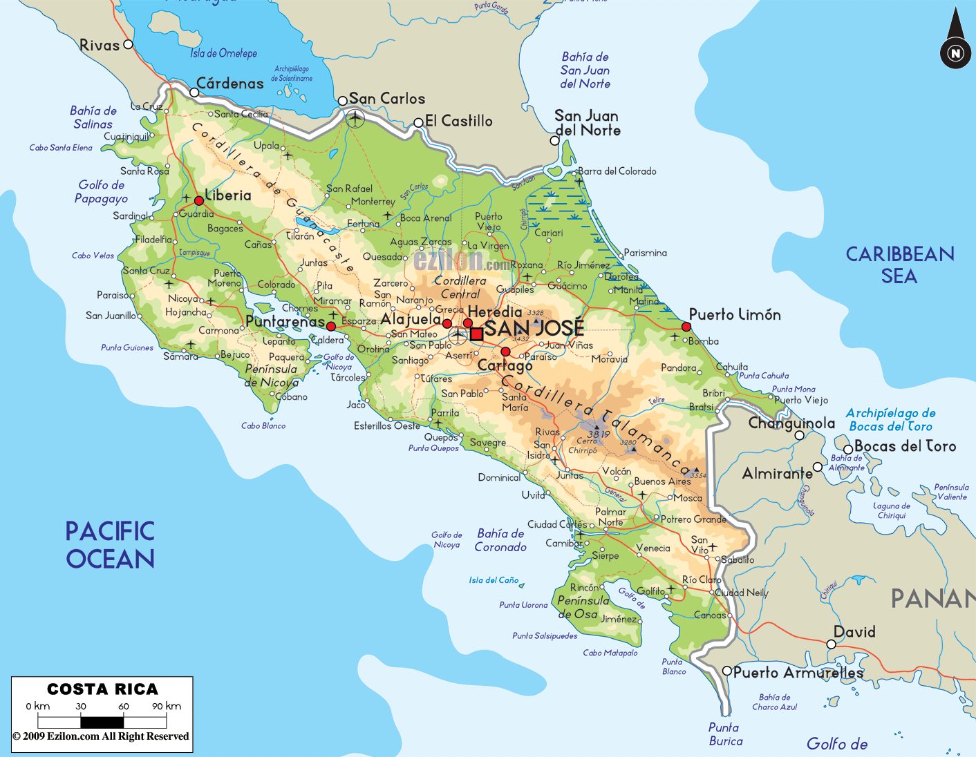
Description : The Physical Map of Costa Rica showing major geographical features like elevations,
mountain ranges, ocean, lakes, plateaus, peninsulas, rivers, plains, landforms and other topographic features.
Costa Rica Physical Facts and
Features...
Costa
Rica is a country situated in the central part of the
South American continent. The country lies between 10
degrees north latitude and 84 degrees west longitude.
The country shares a coastline with the North Pacific
Ocean in the west and the Caribbean Sea to the east. The
total coastline measures in at 1,228 kilometers. The
total area covered by the country is 51,100 square
kilometers out of which 50,660 square kilometers is land
and 440 square kilometers is taken up by water bodies.
The coastal areas are dominated by low lying plains and
the country is bisected by two mountain ranges: the
Cordillera de Talamanca and the Cordillera Central. The
range makes a distinct boundary between both the coasts
and make up the spinal cord of the country.
The rivers in the country drain into 3 main water
sources: the North Pacific Ocean, Caribbean Sea and Lake
Nicaragua. The river originates from the centrally based
mountain ranges. The highest point in the country is
known as Mount Cerro Chirripo and is 3600 meters high.
The San Juan River is the longest in the country as it
flows long before draining into Lake Nicaragua. Other
major rivers include the Colorado, Sapoa and Sierpe
Rivers.
 Costa
Rica is a country situated in the central part of the
South American continent. The country lies between 10
degrees north latitude and 84 degrees west longitude.
The country shares a coastline with the North Pacific
Ocean in the west and the Caribbean Sea to the east. The
total coastline measures in at 1,228 kilometers. The
total area covered by the country is 51,100 square
kilometers out of which 50,660 square kilometers is land
and 440 square kilometers is taken up by water bodies.
Costa
Rica is a country situated in the central part of the
South American continent. The country lies between 10
degrees north latitude and 84 degrees west longitude.
The country shares a coastline with the North Pacific
Ocean in the west and the Caribbean Sea to the east. The
total coastline measures in at 1,228 kilometers. The
total area covered by the country is 51,100 square
kilometers out of which 50,660 square kilometers is land
and 440 square kilometers is taken up by water bodies.


