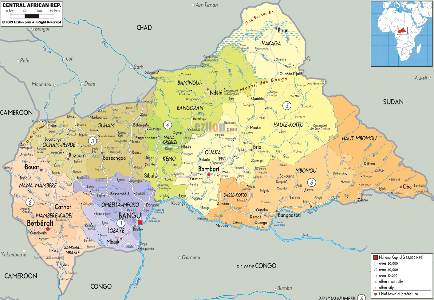
Description: Detailed large political map of Central Africa showing names of capital cities, towns, states, provinces and boundaries of neighbouring countries.
 Behind
its negative reputation of politically violent
brutalities, the Central African Republic reveals other
positive facets, those of splendid national parks that
offer numerous species of wildlife, pristine forests and
magnificent waterfalls. Bangui, the capital is generally
quite a friendly place, which unfortunately can be
dangerous after dark.
Behind
its negative reputation of politically violent
brutalities, the Central African Republic reveals other
positive facets, those of splendid national parks that
offer numerous species of wildlife, pristine forests and
magnificent waterfalls. Bangui, the capital is generally
quite a friendly place, which unfortunately can be
dangerous after dark.
Situated in Central Africa with Bangui as its capital
the Central African Republic borders with, Congo and
Cameroon. A large part of the country consists of a flat
plateau covered by dry deciduous forestland, although in
the southwest a dense tropical rainforest spreads across
the land. In the northwest the landscape changes to form
mountains rising up to 2000mt above sea level.
There are two official languages spoken, French and
Sango as well as 68 different languages and dialects.
Bangui is built on a rock in a tropical setting on the
banks of the River Ubangi and has some interesting sites
to visit such as the Boganda Museum and the Grande
Corniche, a good viewpoint of the Ubangi River and the
fishermen’s settlements.
The Lobaye Region with its indigenous forest tribes and
coffee plantations on the border of the forest is a
magnificent site to visit, as are the Boali Waterfalls
that offer a spectacular experience. One may visit other
breathtaking falls in Bangassou near the border with the
Democratic Republic of Congo; the Kembe Falls are
situated near the Ubangi River. Other sites of interest
are the national parks of Dzanga-Sangha,
Bamingui-Bangoran and Manovo-Gounda St Floris where many
species of wildlife can be spotted including gorillas in
Bayanga.
The country has a hot climate all year round, especially
in the north and the rainy season goes from May to
October.
The people from Central Africa are called Central
African.

Physical Map of Central Africa Republic
Physical map and map image of Central Africa Republic.

Road Map of Central Africa Republic
Road map and map image of Central Africa Republic.

Regional Directory of United States of America
Information and guide about United States of America and websites with American topics.

Regional Directory of Europe
Information and guide about Europe and websites with European topics.

Regional Directory of Australia
Information and guide about Australia and websites with Australian topics.