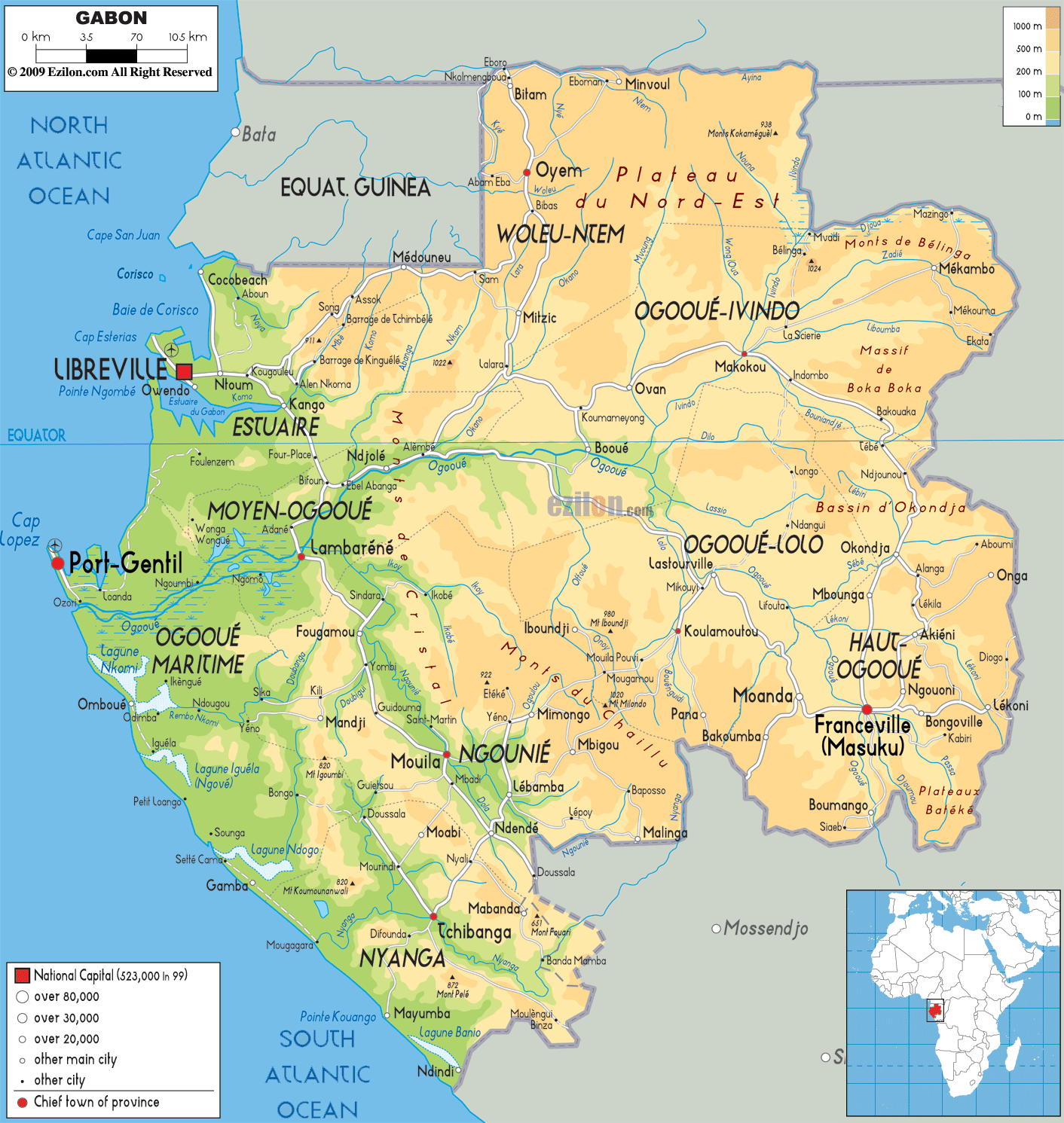
Description: The Physical Map of Gabon showing major geographical features like elevations, mountain ranges, deserts, Ocean, lakes, plateaus, peninsulas, rivers, plains, landforms and other topographic features.
 Gabon
is a country located in West Africa which shares a
coastline with the Atlantic Ocean and Bight of Biafra.
The country lies on the Equator, the geographic
coordinates are 1 degree north latitude and 11 degrees
east longitude. The Equatorial region makes the climate
pretty hot and humid and particularly tropical.
Gabon
is a country located in West Africa which shares a
coastline with the Atlantic Ocean and Bight of Biafra.
The country lies on the Equator, the geographic
coordinates are 1 degree north latitude and 11 degrees
east longitude. The Equatorial region makes the climate
pretty hot and humid and particularly tropical.
Ogooue River is the longest one in the country as it
flows for 1200 kilometers straight. It is the 4th
largest river in Africa after the Niger, Congo and
Zambezi. The river drains over the area of the whole
country. The river originates in the Bateke Plateaux,
flowing northwest it enters the country and drains into
the Gulf of Guinea. The river is un-navigable due the
fast white water rapids flowing endlessly.

Political Map of Gabon
Political map and map image of Gabon.

Road Map of Gabon
Road map and map image of Gabon.

Regional Directory of United States of America
Information and guide about United States of America and websites with American topics.

Regional Directory of Europe
Information and guide about Europe and websites with European topics.

Regional Directory of Australia
Information and guide about Australia and websites with Australian topics.