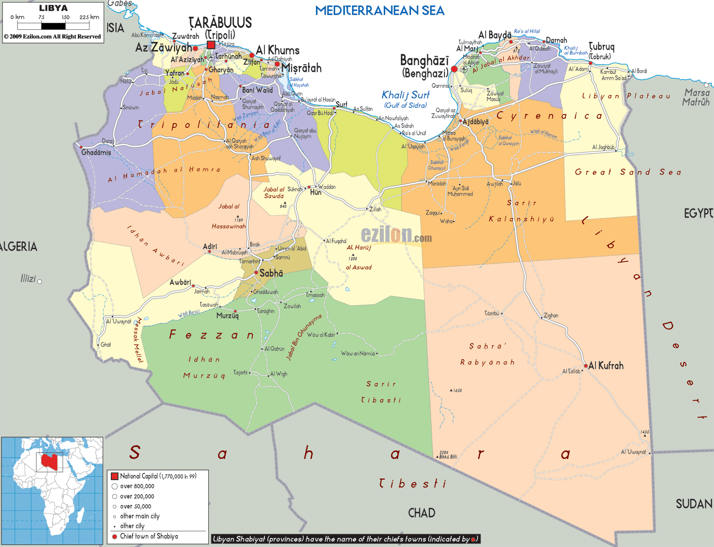
Description: Detailed large political map of Libya showing names of capital cities, towns, states, provinces and boundaries with neighbouring countries.
 Libya
is a country that is situated in the North Africa and it
is also officially known as the Great Socialist People's
Libyan Arab Jamahiriya. You will find the Mediterranean
Sea on the north of Libya and on its south you will find
Niger and Chad. Egypt is located on its east and it is
surrounded by Tunisia and Algeria on its west. More than
4/5th of the country is desert. Libya is considered to
be the seventh largest country in the world. By area, it
is considered to be the fourth largest country in
Africa.
Libya
is a country that is situated in the North Africa and it
is also officially known as the Great Socialist People's
Libyan Arab Jamahiriya. You will find the Mediterranean
Sea on the north of Libya and on its south you will find
Niger and Chad. Egypt is located on its east and it is
surrounded by Tunisia and Algeria on its west. More than
4/5th of the country is desert. Libya is considered to
be the seventh largest country in the world. By area, it
is considered to be the fourth largest country in
Africa.
The people from Libya are called Libyan.

Physical Map of Libya
Physical map and map image of Libya.

Road Map of Libya
Road map and map image of Libya.

Regional Directory of United States of America
Information and guide about United States of America and websites with American topics.

Regional Directory of Europe
Information and guide about Europe and websites with European topics.

Regional Directory of Australia
Information and guide about Australia and websites with Australian topics.