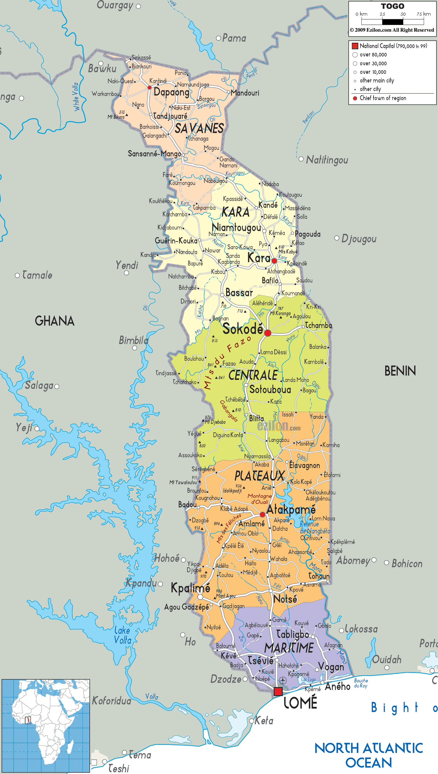
Description: Detailed large political map of Togo showing names of capital cities, towns, states, provinces and boundaries with neighbouring countries.
 Togo
is a nation that is also referred to as the Togolese
Republic and it lies in the West Africa. On the north of
the country there is Burkina Faso, on its east there is
Benin and on its west there is Ghana. On the south of
Togo there is the Gulf of Guinea. The size of the
country is about 57,000 square kilometers and it has
about 6,100,000 individuals living on its land. Lome is
the capital city of Togo and this city is located on the
south of the country. The economy of Togo is highly
dependent on agriculture.
Togo
is a nation that is also referred to as the Togolese
Republic and it lies in the West Africa. On the north of
the country there is Burkina Faso, on its east there is
Benin and on its west there is Ghana. On the south of
Togo there is the Gulf of Guinea. The size of the
country is about 57,000 square kilometers and it has
about 6,100,000 individuals living on its land. Lome is
the capital city of Togo and this city is located on the
south of the country. The economy of Togo is highly
dependent on agriculture.
The people from Togo are called Togolese.

Physical Map of Togo
Physical map and map image of Togo.

Road Map of Togo
Road map and map image of Togo.

Regional Directory of United States of America
Information and guide about United States of America and websites with American topics.

Regional Directory of Europe
Information and guide about Europe and websites with European topics.

Regional Directory of Australia
Information and guide about Australia and websites with Australian topics.