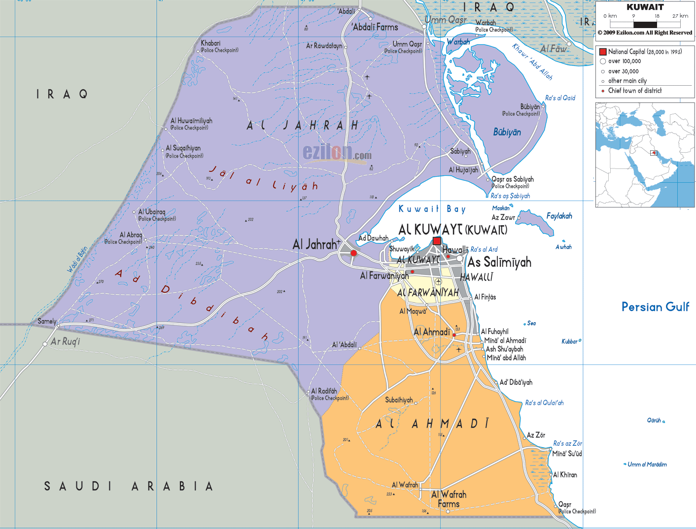
Description: Detailed large political map of Kuwait showing names of capital city, towns, states, provinces and boundaries with neighbouring countries.
 Kuwait
is located in the Middle East and borders with Iraq and
Saudi Arabia. It looks out onto the Persian Gulf where
nine other islands belonging to Kuwait lie. The capital
is Kuwait City and the official language is Arabic,
although English is widespread.
Kuwait
is located in the Middle East and borders with Iraq and
Saudi Arabia. It looks out onto the Persian Gulf where
nine other islands belonging to Kuwait lie. The capital
is Kuwait City and the official language is Arabic,
although English is widespread.
The country’s landscape is mostly composed of a desert
plateau with a lower, more fertile coastal area. The
Faikakai Island is a Bronze Age and Greek archeological
site and can be reached by ferry. Here in Al Jahrah
traditional style boats are still built for pearl
fishing or trade.
Kuwait City is a bustling metropolis of high-rise office
buildings, luxury hotels, wide boulevards and
well-tended parks and gardens. Its most dominant
landmark is Kuwait Towers, and the oldest is Seif
Palace, built in 1896, the interior of which features
original Islamic mosaic tile work.
There are many sea clubs in Kuwait that offer a wide
range of facilities, with swimming pools, beaches, gyms
and other outdoor activities such as scuba diving and
boating, horseback riding is also very popular in
winter.
Kuwait climate has four main seasons with hot and dry
summers from April to October and cool winters with
little rain.

Physical Map of Kuwait
Physical map and map image of Kuwait.

Road Map of Kuwait
Road map and map image of Kuwait.

Regional Directory of United States of America
Information and guide about United States of America and websites with American topics.

Regional Directory of Europe
Information and guide about Europe and websites with European topics.

Regional Directory of Australia
Information and guide about Australia and websites with Australian topics.