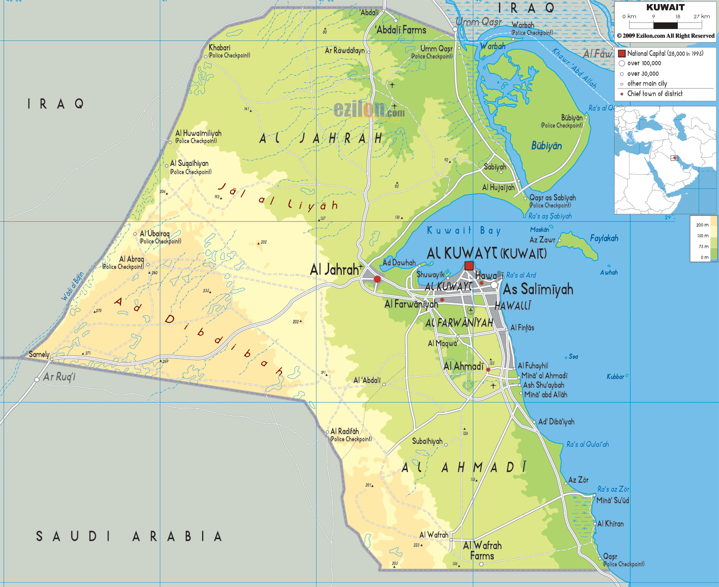
Description: The Physical Map of Kuwait showing major geographical features like elevations, mountain ranges, deserts, seas, lakes, plateaus, peninsulas, rivers, plains, landforms and other topographic features.
This map of Kuwait with mountains, hills, lakes, rivers and other terrains is already large enough to read directly on your desktop. To see a full-screen zoom view on a phone or tablet, tap the map image (or tap the Zoom Map label above the image). Scan by shading governorates in various colored blocks, with Kuwait's mountains, hills, lakes and rivers in bold.
 In
West Asia, Kuwait is an Arab country with official name
as the State of Kuwait. It has boundaries with Saudi
Arabia and Iraq. It is located on the northern most tip
of the Gulf of Persia.
In
West Asia, Kuwait is an Arab country with official name
as the State of Kuwait. It has boundaries with Saudi
Arabia and Iraq. It is located on the northern most tip
of the Gulf of Persia.
With only an area of 860 square kilometres it is among
the smallest countries of the world. Its highest point
is only at 306 metres above the sea level and the
country’s topography is generally low lying.
Oil reserves of approximately 70 billion barrels are
found in the Burgan field of Kuwait. Kuwait’s eastern
and south-eastern parts are cannot be used for living
for the soil of that area is contaminated because of
soot and oil accumulation.
Kuwait’s desert area has been turned into semi-asphalt
surfaces because of oil and sand residue. Marine
resources of Kuwait are very much affected by the oil
spills during the Gulf War and are reduced drastically.

Political Map of Kuwait
Political map and map image of Kuwait.

Road Map of Kuwait
Road map and map image of Kuwait.

Regional Directory of United States of America
Information and guide about United States of America and websites with American topics.

Regional Directory of Europe
Information and guide about Europe and websites with European topics.

Regional Directory of Australia
Information and guide about Australia and websites with Australian topics.