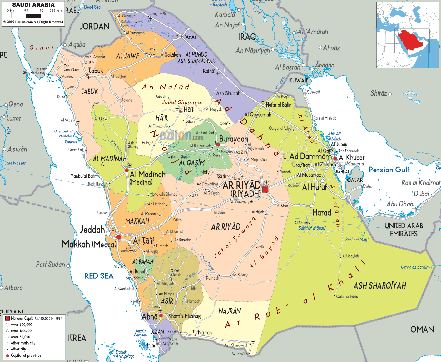
Description: Detailed large political map of Saudi Arabia showing names of capital city, towns, states, provinces and boundaries with neighbouring countries.
 Saudi
Arabia is the largest nation in the Arabian Peninsula
and it is also an Arab country. On its east it has the
U.A.E, Bahrain and Qatar; on its south it has Yemen,
Iraq is situated on its north, Jordan on its northwest
and Oman on its south. Saudi Arabia is also referred to
as The Land of the Two Holy Mosques at times because it
is home to Mecca and Medinah, Islam’s two holiest
locations. The country leads the world as the top
petroleum exporter. In fact, the petroleum industry is a
very vital part of its economy.
Saudi
Arabia is the largest nation in the Arabian Peninsula
and it is also an Arab country. On its east it has the
U.A.E, Bahrain and Qatar; on its south it has Yemen,
Iraq is situated on its north, Jordan on its northwest
and Oman on its south. Saudi Arabia is also referred to
as The Land of the Two Holy Mosques at times because it
is home to Mecca and Medinah, Islam’s two holiest
locations. The country leads the world as the top
petroleum exporter. In fact, the petroleum industry is a
very vital part of its economy.

Physical Map of Saudi Arabia
Physical map and map image of Saudi Arabia.

Road Map of Saudi Arabia
Road map and map image of Saudi Arabia.

Regional Directory of United States of America
Information and guide about United States of America and websites with American topics.

Regional Directory of Europe
Information and guide about Europe and websites with European topics.

Regional Directory of Australia
Information and guide about Australia and websites with Australian topics.