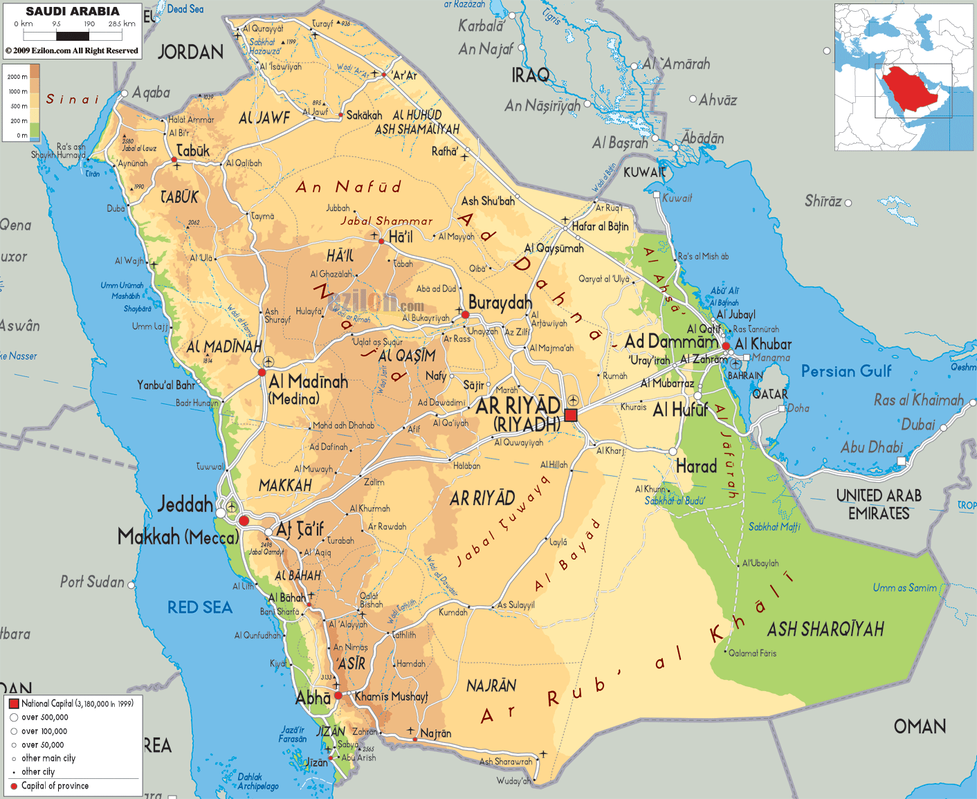
Description: The Physical Map of Saudi Arabia showing major geographical features like elevations, mountain ranges, deserts, seas, lakes, plateaus, peninsulas, rivers, plains, landforms and other topographic features.
 Saudi
Arabia officially called the Kingdom of Saudi Arabia is
the largest of all the Arab countries. It is situated in
West Asia. Approximately 2,150,000 square kilometres is
the total area of the country. Its bordering countries
are Oman to the southeast, United Arab Emirates, Qatar,
Bahrain to the east, Jordan and Iraq to the north, Yemen
in the south and Kuwait to the northeast.
Saudi
Arabia officially called the Kingdom of Saudi Arabia is
the largest of all the Arab countries. It is situated in
West Asia. Approximately 2,150,000 square kilometres is
the total area of the country. Its bordering countries
are Oman to the southeast, United Arab Emirates, Qatar,
Bahrain to the east, Jordan and Iraq to the north, Yemen
in the south and Kuwait to the northeast.
It has coastlines with a Persian Gulf and a Red Sea. Most of the country is desert which is not suitable for living. The Arabian Desert is the prominent feature of Saudi Arabia. 647,500 square kilometres is Rub' al Khali which is the approx area of its desert in the south. In the country of Saudi Arabia there are no lakes and rivers.
There are very few fertile regions which are located in
the oases, basins, and the alluvial deposits in wadis.
The central plateau is the main geographical landscape
which originated from the the Red Sea. Mount Sawda at
3,133 metres is the highest point in the country of
Saudi Arabia. There is a narrow coastal plain along the
coast of Red Sea. Large variety of marine life is found
in the Persian Gulf.

Political Map of Saudi Arabia
Political map and map image of Saudi Arabia.

Road Map of Saudi Arabia
Road map and map image of Saudi Arabia.

Regional Directory of United States of America
Information and guide about United States of America and websites with American topics.

Regional Directory of Europe
Information and guide about Europe and websites with European topics.

Regional Directory of Australia
Information and guide about Australia and websites with Australian topics.