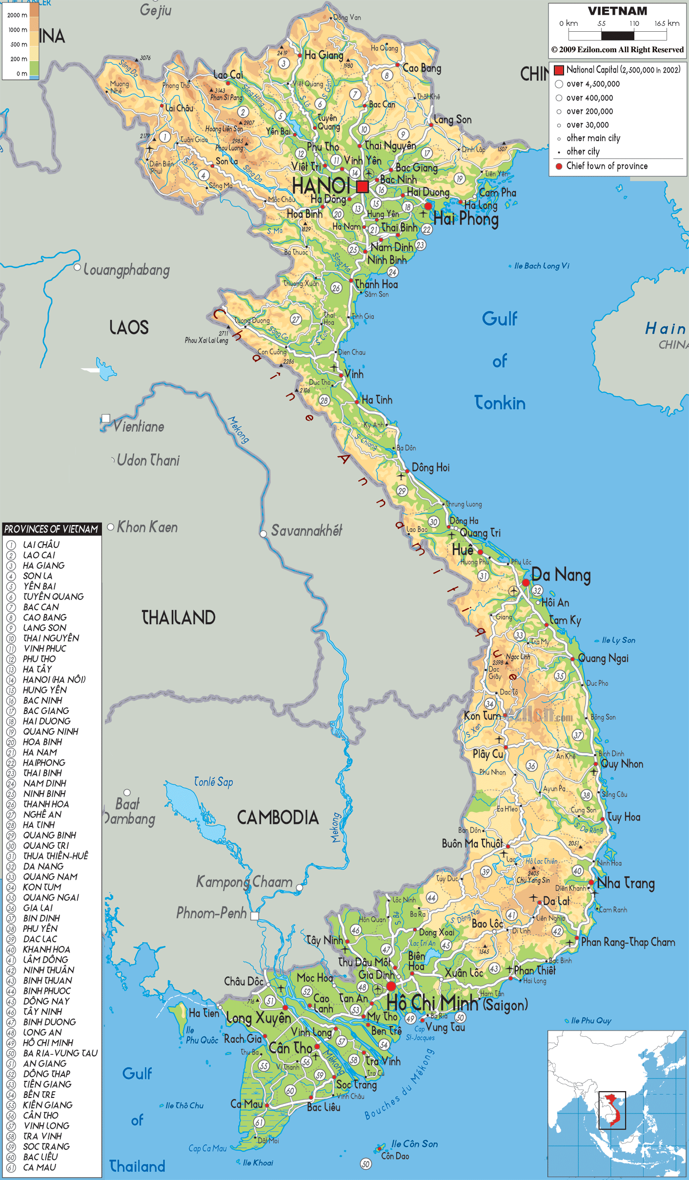
Description: The Physical Map of Vietnam showing major geographical features like elevations, mountain ranges, ocean, lakes, plateaus, peninsulas, rivers, plains, landforms and other topographic features.
 The
Vietnamese country lies at the eastern end of the
Indochinese Peninsula. The area covered by the country
is 331212 square kilometres. The country borders three
major water bodies, namely, the Gulf of Tonkin, Gulf of
Thailand and the South China Sea.
The
Vietnamese country lies at the eastern end of the
Indochinese Peninsula. The area covered by the country
is 331212 square kilometres. The country borders three
major water bodies, namely, the Gulf of Tonkin, Gulf of
Thailand and the South China Sea.
The country is shaped like the alphabet S and measures
in at 1650 from top to bottom and 950 kilometres across
its narrowest point. The country also has a 1260
kilometre long coastline.
Physiologically the country is separated into the Red
River Delta and highlands in the north, the Mekong River
Delta, Chaine Mountain Range and lowlands to the south.
The Mekong River Delta spans across an area measuring
40000 square kilometres. The river itself is 4220
kilometres long. The two tributaries of the Mekong are
the Bassac River and Tien Giang River. The lowest point
in the country is under the South China Sea.

Political Map of Vietnam
Political map and map image of Vietnam.

Road Map of Vietnam
Road map and map image of Vietnam.

Regional Directory of United States of America
Information and guide about United States of America and websites with American topics.

Regional Directory of Europe
Information and guide about Europe and websites with European topics.

Regional Directory of Australia
Information and guide about Australia and websites with Australian topics.