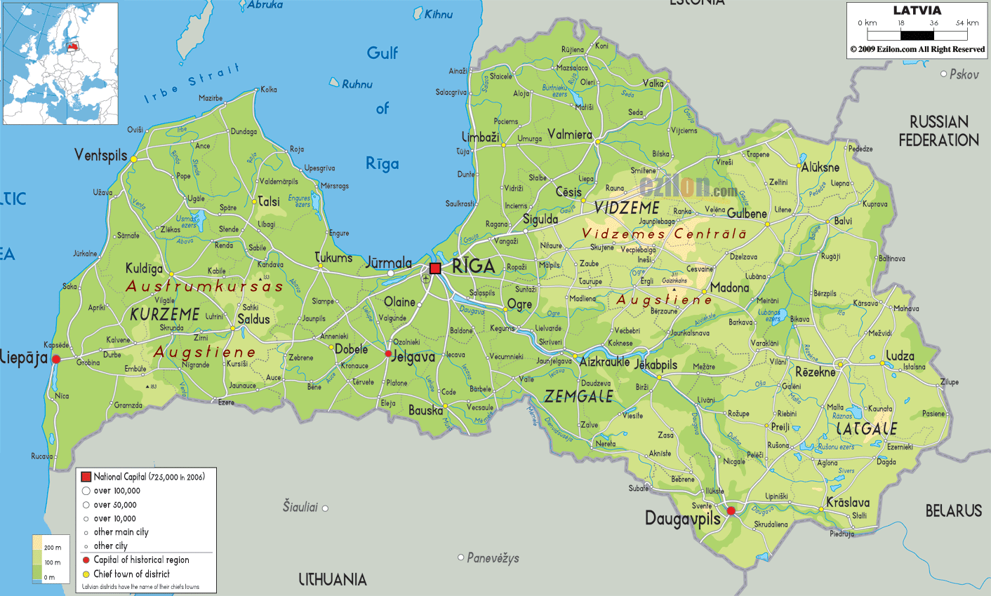
Description: The physical map of Latvia showing major geographical features like elevations, seas, lakes, plateaus, vegetations, peninsulas, rivers, plains, landforms and other topographic features.
 Latvia
is a country located in the Eastern Europe and on the
eastern coast of the Baltic Sea. It is a low lying
region as the average elevation of the land is below 200
meters above sea level.
Latvia
is a country located in the Eastern Europe and on the
eastern coast of the Baltic Sea. It is a low lying
region as the average elevation of the land is below 200
meters above sea level.
There are about 12000 rivers in the country out of which
only 17 run for 60 miles or more. The most important
rivers in the country are Lielupe, Daugava, Gauja,
Salaca and Venta.
The country is mostly covered by forests which are
majorly pine trees. The country also has a 531 kilometer
long coastline by the Baltic Sea.
The country spans an area of 64589 square kilometers.
The Daugava is the longest river in the country and it
flows for 1020 kilometers. The river originates from the
Valday Hills in Russia and crosses the Latvian landscape
to drain into the Gulf of Riga.
The highest peak in the country is called Gaizinkalns
and is 312 meters high whereas the lowest point is less
than a meter deep under the Baltic Sea.
The country lies between north latitude 57 and east
longitude 25 degrees. There are over 3000 lakes in the
country, majority of which are eutrophic. Lake Lubans is
the biggest lake in the Latvian country which has an
outflow to the Daugava river.

Political Map of Latvia
Political map and map image of Latvia.

Road Map of Latvia
Road map and map image of Latvia.

Regional Directory of United States of America
Information and guide about United States of America and websites with American topics.

Regional Directory of Europe
Information and guide about Europe and websites with European topics.

Regional Directory of Australia
Information and guide about Australia and websites with Australian topics.