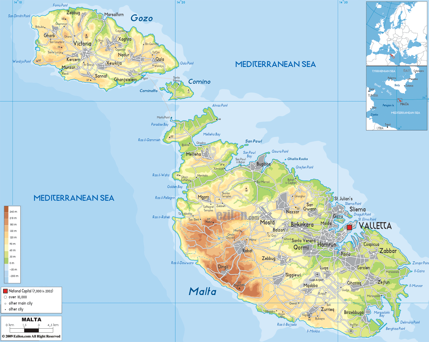
Description: The physical map of Malta showing major geographical features like elevations, islands, mountain ranges, seas, lakes, plateaus, peninsulas, rivers, plains, landforms and other topographic features.
 Malta
is an island country surrounded by the Mediterranean
Sea. It is an Archipelago made of coralline limestone
and a part of Europe.
Malta
is an island country surrounded by the Mediterranean
Sea. It is an Archipelago made of coralline limestone
and a part of Europe.
The country lies between north latitude 35.50 degrees
and east longitude 14.35 degrees. The country’s
ecological areas are mostly dominated by water and high
terraced fields with rolling hills. The highest natural
point is 253 meters tall and is called the Ta Zuta.
The country covers an area of 316 square kilometers all
of which is land and is indented with numerous bays and
small islands.
The country’s coastline is 196.8 kilometers long all of
which is surrounded by the Mediterranean Sea. The lowest
point is under the Mediterranean Sea and is less than a
meter in depth.
There are no permanent rivers in the country. They only
flow during the monsoons or wet season. There are a few
exceptions which have a little fresh water all year
round: Bahrija, San Martin and Lunzjata. The continental
shelf of the country has a drop of 200 meters.

Political Map of Malta
Political map and map image of Malta.

Road Map of Malta
Road map and map image of Malta.

Regional Directory of United States of America
Information and guide about United States of America and websites with American topics.

Regional Directory of Europe
Information and guide about Europe and websites with European topics.

Regional Directory of Australia
Information and guide about Australia and websites with Australian topics.