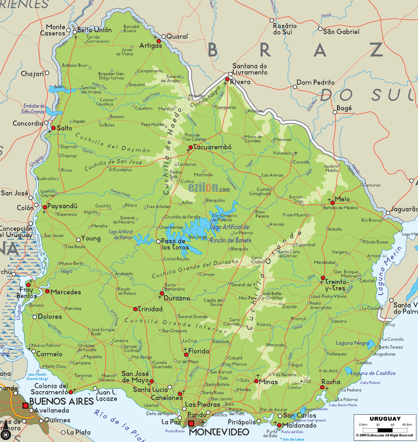
Description: The Physical Map of Uruguay showing major geographical features like elevations, ocean, lakes, plateaus, peninsulas, rivers, plains, landforms and other topographic features.
 TUruguay
is a country which is officially called the República
Oriental del Uruguay and lies in southeast South
America. It is surrounded by Argentina on its west and
Brazil on its north-east, with the Atlantic Ocean to the
south and southeast. With an area of approximately
176,000 square kilometres Uruguay is geographically the
second-smallest nation in South America after Suriname.
TUruguay
is a country which is officially called the República
Oriental del Uruguay and lies in southeast South
America. It is surrounded by Argentina on its west and
Brazil on its north-east, with the Atlantic Ocean to the
south and southeast. With an area of approximately
176,000 square kilometres Uruguay is geographically the
second-smallest nation in South America after Suriname.
The country’s highest point is the Cerro Catedral which
stands at a height of 515metresabove the sea level. The
region has a varied topography with 10 national parks:
Five are based in the wetland areas in the east, 3 are
situated in the central region, and there is 1 along the
Rio Uruguayin the west.

Political Map of Uruguay
Political map and map image of Uruguay.

Regional Directory of South America
Information and guide about South America and website listing.

Regional Directory of United States of America
Information and guide about United States of America and websites with American topics.

Regional Directory of Europe
Information and guide about Europe and websites with European topics.

Regional Directory of Australia
Information and guide about Australia and websites with Australian topics.