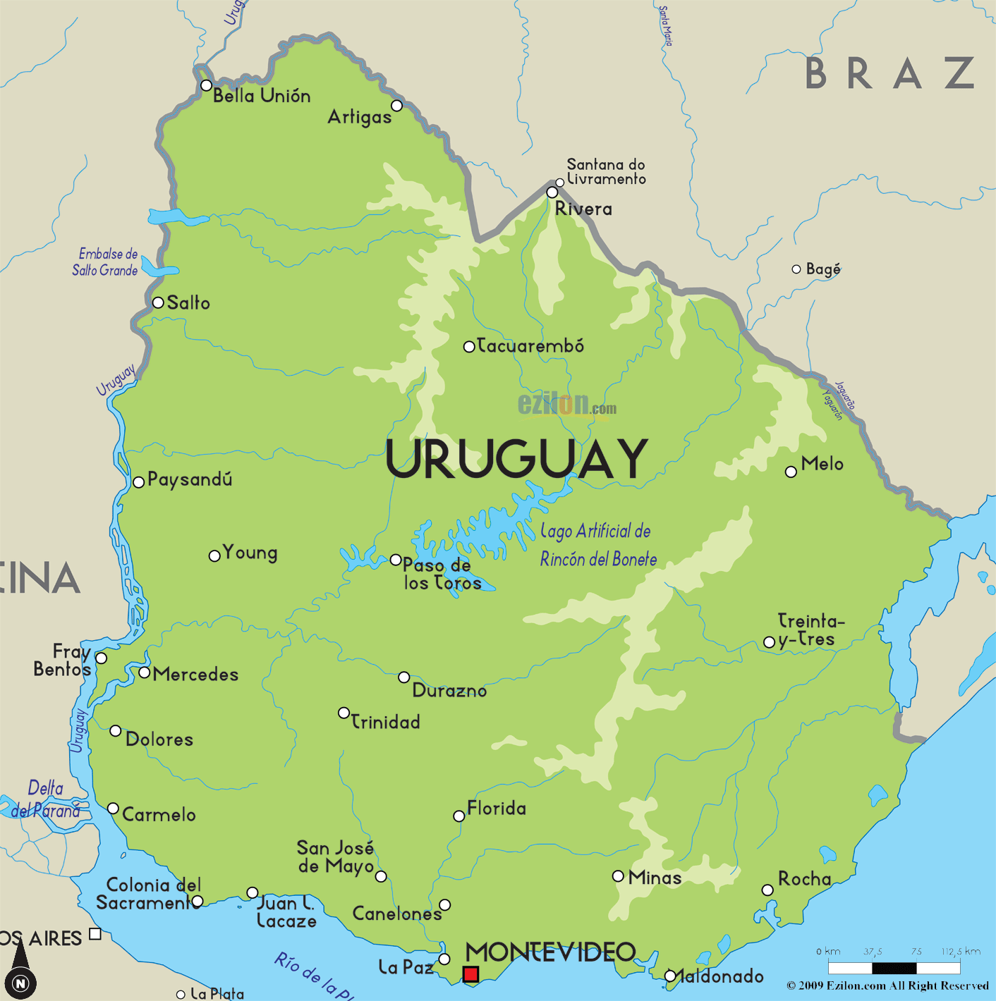
The
Oriental Republic of Uruguay (or Uruguay as it is
commonly referred to as) is situated in the south of
America and it has a population of about 3.46 million.
Of this number, about 1.7 people live in the capital
city of the country and it is called Montevideo. This
city is a metropolitan city. More than 4/5th of the
people living in Uruguay are of European and mixed
ethnicities. The South Atlantic Ocean is situated on the
southeast of the country and on its southwest there is
the estuary of Rio de la Plata. The
Oriental Republic of Uruguay (or Uruguay as it is
commonly referred to as) is situated in the south of
America and it has a population of about 3.46 million.
Of this number, about 1.7 people live in the capital
city of the country and it is called Montevideo. This
city is a metropolitan city. More than 4/5th of the
people living in Uruguay are of European and mixed
ethnicities. The South Atlantic Ocean is situated on the
southeast of the country and on its southwest there is
the estuary of Rio de la Plata.
Uruguay is considered to
be South America’s second smallest nation and it has an
area of about 68,036 square miles. Its landscape
includes low hill ranges and rolling plains.
The Cerro Catedral located in the Sierra Carape hill
range is the highest point in Uruguay and it stands tall
at 1,685 ft. The country experiences a temperate climate
with cold winters and hot summers. While frost is common
in the country, snow is not.
Spanish is a language that
is commonly spoken in Uruguay. Most of the ethnic groups
are of Italian and Spanish origins. There are people of
other ethnic groups as well like the Greeks, Austrians,
Lithuanians, Irish, British, Portuguese, Germans, etc.
|