New Hampshire Map -
Geographical Map of
New Hampshire
Geographical Map of
New Hampshire and
New Hampshire Details Maps...
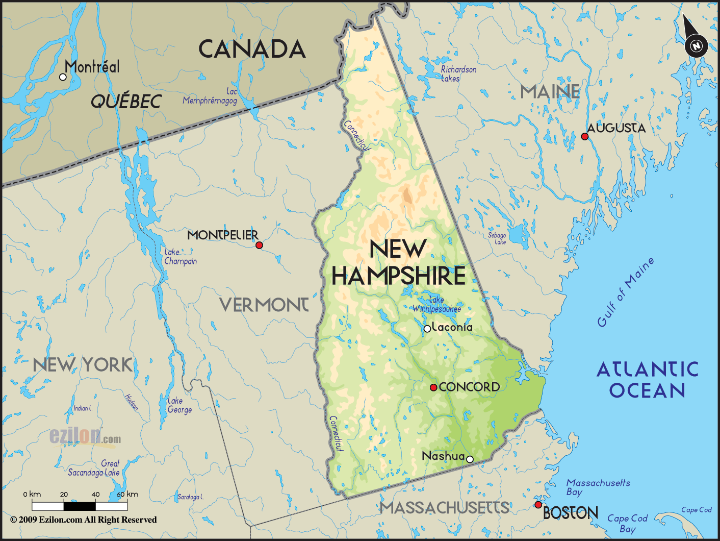
New
Hampshire is a state that is located in the northeastern
part of the United States. It lies in the New England
region of the country and it has been named after the
English county of Hampshire. In terms of land area, New
Hampshire is considered to be 44th largest state in the
country but in terms of population this state ranks 41st
in the country.
On the north of the country, New
Hampshire is bordered by Quebec, on its east it faces
the Atlantic Ocean and Maine, on its west it is bordered
by Vermont and on its south it is bordered by
Massachusetts.
This state is the first state in the United States with
its own state constitution. Manchester is the largest
city in New Hampshire and Concord is the capital of the
state.
The world recognizes this state for the New
Hampshire primary. The Granite State is the nickname of
New Hampshire. Some of the recreational activities here
are mountaineering, snowmobiling, hiking, skiing,
different kinds of winter sports, etc.
Lake
Winnipesaukee is the largest lake in New Hampshire and
this is followed by the Lake Umbagog. Some times, this
state is affected by tropical storms and hurricanes.
 New
Hampshire is a state that is located in the northeastern
part of the United States. It lies in the New England
region of the country and it has been named after the
English county of Hampshire. In terms of land area, New
Hampshire is considered to be 44th largest state in the
country but in terms of population this state ranks 41st
in the country.
New
Hampshire is a state that is located in the northeastern
part of the United States. It lies in the New England
region of the country and it has been named after the
English county of Hampshire. In terms of land area, New
Hampshire is considered to be 44th largest state in the
country but in terms of population this state ranks 41st
in the country.


