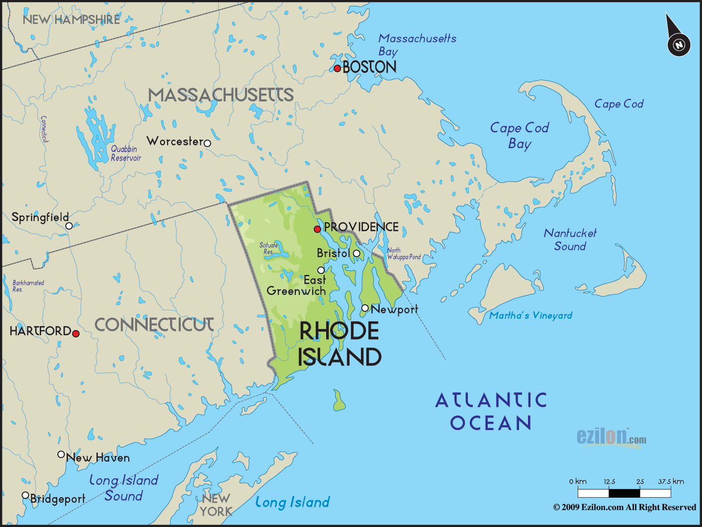
 Rhode
Island is an American State that is located in the New
England region of U.S.A. On the east and north of Rhode
Island there is Massachusetts and on its west there is
Connecticut. Even though its name is Rhode Island, the
majority of the state is actually on the mainland. Rhode
Island is an American State that is located in the New
England region of U.S.A. On the east and north of Rhode
Island there is Massachusetts and on its west there is
Connecticut. Even though its name is Rhode Island, the
majority of the state is actually on the mainland.
Sometimes, this state is also unofficially known as
Little Rhody. Its official name is Rhode Island and
Providence Plantations and this is the longest official
name among the states in the United States.
The state is
about 4,002 square kilometers in area and it is bordered
by the Atlantic Ocean on the south. On the west Rhode
Island, there is Connecticut and on its east and north
there is Massachusetts.
Rhode Island is also known as the Ocean State and there
are many ocean front beaches here. The state is
basically flat and it does not have real mountains.
Jerimoth Hill is the highest point in Rhode Island and
it stands at just eight hundred and twelve feet. Most of
the people living in this state are from six ethnic
groups and these are Italian, English, Hispanic, Irish,
French Canadian and Portuguese.
Roman Catholicism is the
main religion that most of the people in Rhode Island
follow.
|