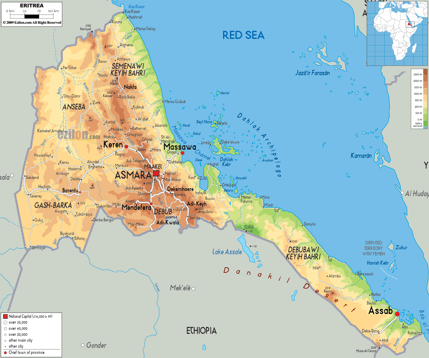
Description: The Physical Map of Eritrea showing major geographical features like elevations, mountain ranges, deserts, seas, lakes, plateaus, peninsulas, rivers, plains, landforms and other topographic features.
 Eritrea
is a country placed within the horn of the African
continent. The north and northeastern borders of the
nation are taken up by the Red Sea. The geographic
coordinates of the country are 15 degrees north latitude
and 39 degrees east longitude. The total area taken up
by the country measures in at 124320 square kilometers
and 121320 square kilometers of it is land while 4000
square kilometers is occupied by water bodies. 2234
kilometers is the total length of the coastline the
nation shares with the Red Sea.
Eritrea
is a country placed within the horn of the African
continent. The north and northeastern borders of the
nation are taken up by the Red Sea. The geographic
coordinates of the country are 15 degrees north latitude
and 39 degrees east longitude. The total area taken up
by the country measures in at 124320 square kilometers
and 121320 square kilometers of it is land while 4000
square kilometers is occupied by water bodies. 2234
kilometers is the total length of the coastline the
nation shares with the Red Sea.
The central part of the country is taken up by the
central plateaus which sit about 1800-3000 meters above
sea level. The coastal plains are another ecological
area of the nation and the west of the country is taken
up by low lying plains. The country lacks a perennial
river as the rivers flow only during the wet seasons.
Mount Soira at 3018 meters above sea level is the
highest natural peak present, whereas Lake Kulul is the
lowest point. The Lake rest in the Afar Depression at 75
meters below sea level. Most of the country's highlands
are a carry forward from the neighboring nation of
Ethiopia which gradually dies out near the coast.

Political Map of Eritrea
Political map and map image of Eritrea.

Road Map of Eritrea
Road map and map image of Eritrea.

Regional Directory of United States of America
Information and guide about United States of America and websites with American topics.

Regional Directory of Europe
Information and guide about Europe and websites with European topics.

Regional Directory of Australia
Information and guide about Australia and websites with Australian topics.