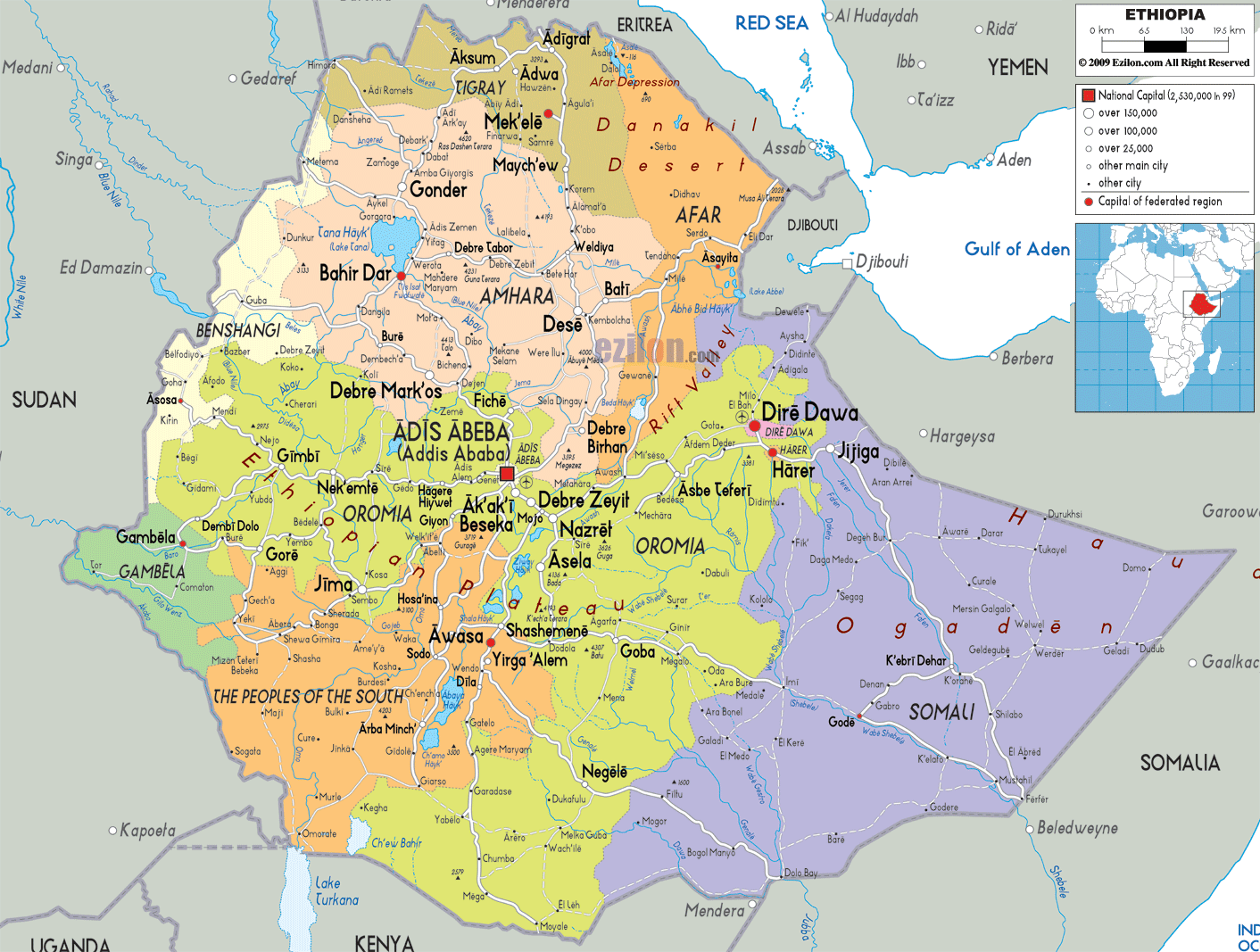
Detailed map of Ethiopia with cities, towns, regions, villages and surrounding countries. Ethiopia is landlocked and shares its borders with Eritrea, Djibouti, Somalia, Kenya and Sudan.
This map of Ethiopia with cities, regions, and towns is already large enough to read directly on your desktop. To see a full-screen zoom view on a phone or tablet, tap the map image (or tap the Zoom Map label above the image). Scan by shading regions in various colored blocks, with Ethiopia's cities and towns in bold.
 Ethiopia
is situated in Northeast Africa bordered by Sudan,
Kenya, Eritrea, Somalia and Djibouti, offering some of
the highest and fascinating sites in Africa.
Ethiopia
is situated in Northeast Africa bordered by Sudan,
Kenya, Eritrea, Somalia and Djibouti, offering some of
the highest and fascinating sites in Africa.
The people from Ethiopia are called Ethiopians.

Physical Map of Ethiopia
Physical map and map image of Ethiopia.

Road Map of Ethiopia
Road map and map image of Ethiopia.

Regional Directory of United States of America
Information and guide about United States of America and websites with American topics.

Regional Directory of Europe
Information and guide about Europe and websites with European topics.

Regional Directory of Australia
Information and guide about Australia and websites with Australian topics.
