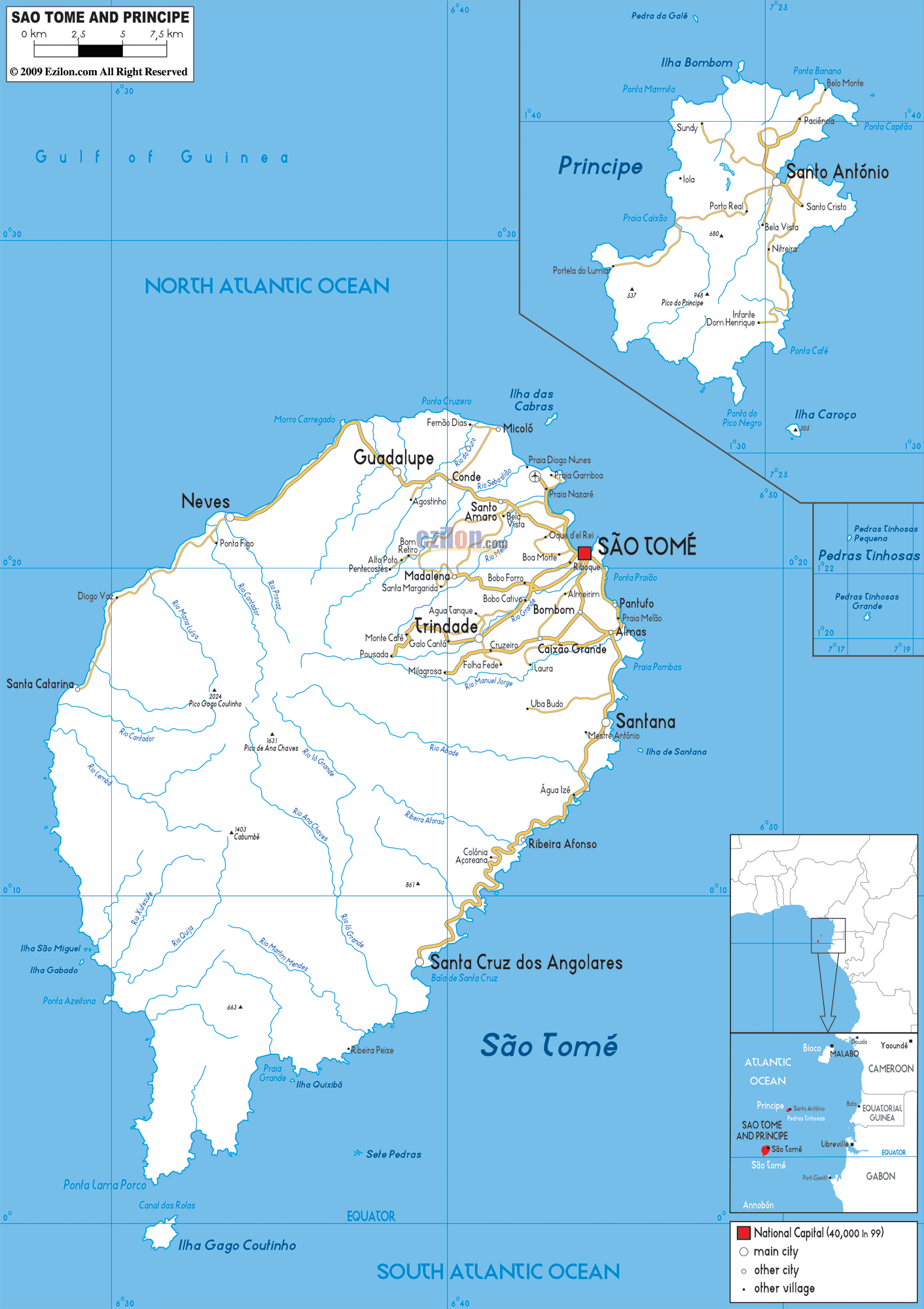
Detailed map of Sao Tome and Principe with Road Map of Sao Tome and Principe with Highways and Expressways etc. Sao Tome and Principe is an island nation located near Gabon and Equatorial Guinea.
This map of Sao Tome and Principe with highways, expressways, and roads is already large enough to read directly on your desktop. To see a full-screen zoom view on a phone or tablet, tap the map image (or tap the Zoom Map label above the image). Scan by shading districts in various colored blocks, with Sao Tome and Principe's highways and expressways in bold.
 Sao Tome
and Principe is an island nation located in the Gulf of
Guinea. The Democratic Republic of Sao Tome and Principe
is made up of two islands, Sao Tome and Principe. These
islands are situated about one hundred and forty kilometers
apart from each other. The population of this nation
speaks Portuguese. There are about one hundred and forty
thousand people living in this nation and they are of
mixed origins (European, Capeverdian and Angolan origins).
Sao Tome
and Principe is an island nation located in the Gulf of
Guinea. The Democratic Republic of Sao Tome and Principe
is made up of two islands, Sao Tome and Principe. These
islands are situated about one hundred and forty kilometers
apart from each other. The population of this nation
speaks Portuguese. There are about one hundred and forty
thousand people living in this nation and they are of
mixed origins (European, Capeverdian and Angolan origins).
The people from Sao Tome and Principe are called Sao Tomeans.

Political Map of Sao Tome and Principe
Political map and map image of Sao Tome and Principe.

Physical Map of Sao Tome and Principe
Physical map and map image of Sao Tome and Principe.

Regional Directory of United States of America
Information and guide about United States of America and websites with American topics.

Regional Directory of Europe
Information and guide about Europe and websites with European topics.

Regional Directory of Australia
Information and guide about Australia and websites with Australian topics.
