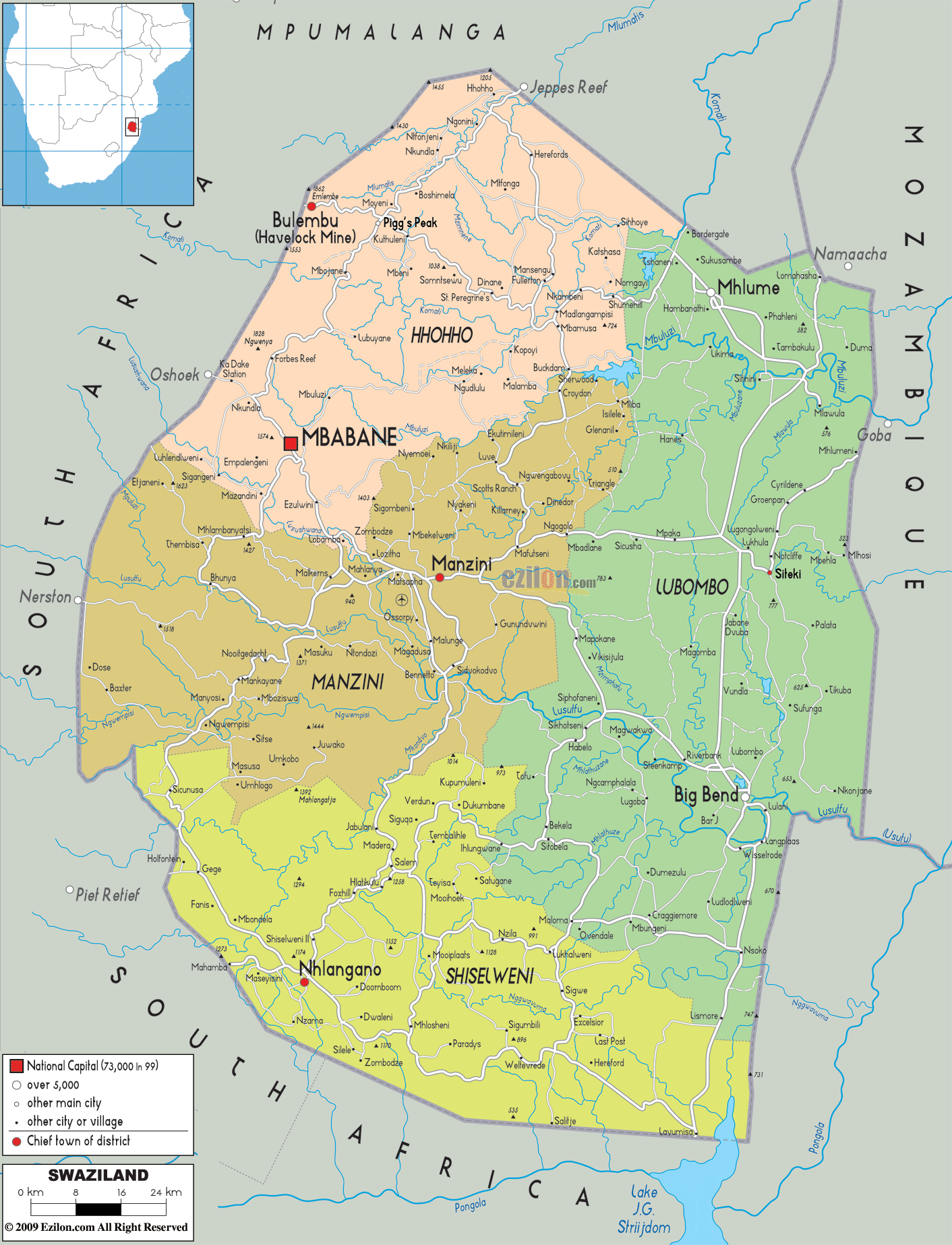
Description: Detailed large political map of Swaziland showing names of capital cities, towns, states, provinces and boundaries with neighbouring countries.
This map of Swaziland with cities, regions, and towns is already large enough to read directly on your desktop. To see a full-screen zoom view on a phone or tablet, tap the map image (or tap the Zoom Map label above the image). Scan by shading regions in various colored blocks, with Swaziland's cities and towns in bold.
 Swaziland
is a landlocked country that is located in Southern
Africa and it is also known as Ngwane. At present, the
people of the country are basically Swazis that can
communicate in Bantu.
The industries that are important
for the economy of this country are subsistence farming,
agriculture and services industry.
The development of the country has been obstructed by AIDS and HIV. The
country has the highest number of people with AIDS/HIV.
About thirteen percent of the country's Gross Domestic
Product depends on forestry, agriculture and mining. The
manufacturing industry in the country accounts for about
37% of the total GDP of Swaziland.
Swaziland
is a landlocked country that is located in Southern
Africa and it is also known as Ngwane. At present, the
people of the country are basically Swazis that can
communicate in Bantu.
The industries that are important
for the economy of this country are subsistence farming,
agriculture and services industry.
The development of the country has been obstructed by AIDS and HIV. The
country has the highest number of people with AIDS/HIV.
About thirteen percent of the country's Gross Domestic
Product depends on forestry, agriculture and mining. The
manufacturing industry in the country accounts for about
37% of the total GDP of Swaziland.
The people from Swaziland are called Swazis.

Physical Map of Swaziland
Physical map and map image of Swaziland.

Road Map of Swaziland
Road map and map image of Swaziland.

Regional Directory of United States of America
Information and guide about United States of America and websites with American topics.

Regional Directory of Europe
Information and guide about Europe and websites with European topics.

Regional Directory of Australia
Information and guide about Australia and websites with Australian topics.