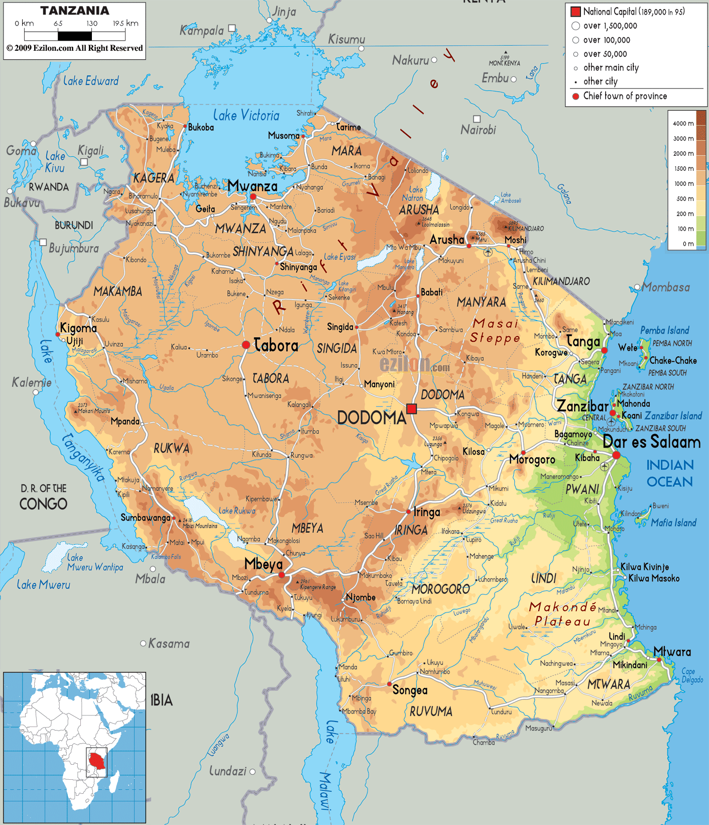
Detailed Physical map of Tanzania showing mountains, valleys, elevations and other topographic features. Tanzania shares its borders with Kenya, Uganda, Rwanda, Burundi, Democratic Republic of the Congo, Zambia, Malawi and Mozambique.
This map of Tanzania with mountains, hills, lakes, rivers and other terrains is already large enough to read directly on your desktop. To see a full-screen zoom view on a phone or tablet, tap the map image (or tap the Zoom Map label above the image). Scan by shading regions in various colored blocks, with Tanzania's mountains, hills, lakes and rivers in bold.
 Tanzania,
officially the United Republic of Tanzania is a country
in the East. It is surrounded by Kenya and Uganda in the
north. To its west, it has Rwanda, the Burundi as well
as theDemocratic Republic of the Congo. To its south it
has the Zambia, the Malawi, and the Mozambique.
Tanzania,
officially the United Republic of Tanzania is a country
in the East. It is surrounded by Kenya and Uganda in the
north. To its west, it has Rwanda, the Burundi as well
as theDemocratic Republic of the Congo. To its south it
has the Zambia, the Malawi, and the Mozambique.
The nation's eastern border touches the Indian Ocean.
Mt. Kilimanjaro, the highest mountain in Africa, is
situated in northeastern Tanzania. It covers around
948,000 square kilometres and considered the 13th
largest country in Africa as well as the the 31st
largest in the world. It has a coastline along the
Indian Ocean which is approximately 800 kilometres long.

Political Map of Tanzania
Political map and map image of Tanzania.

Road Map of Tanzania
Road map and map image of Tanzania.

Regional Directory of United States of America
Information and guide about United States of America and websites with American topics.

Regional Directory of Europe
Information and guide about Europe and websites with European topics.

Regional Directory of Australia
Information and guide about Australia and websites with Australian topics.
