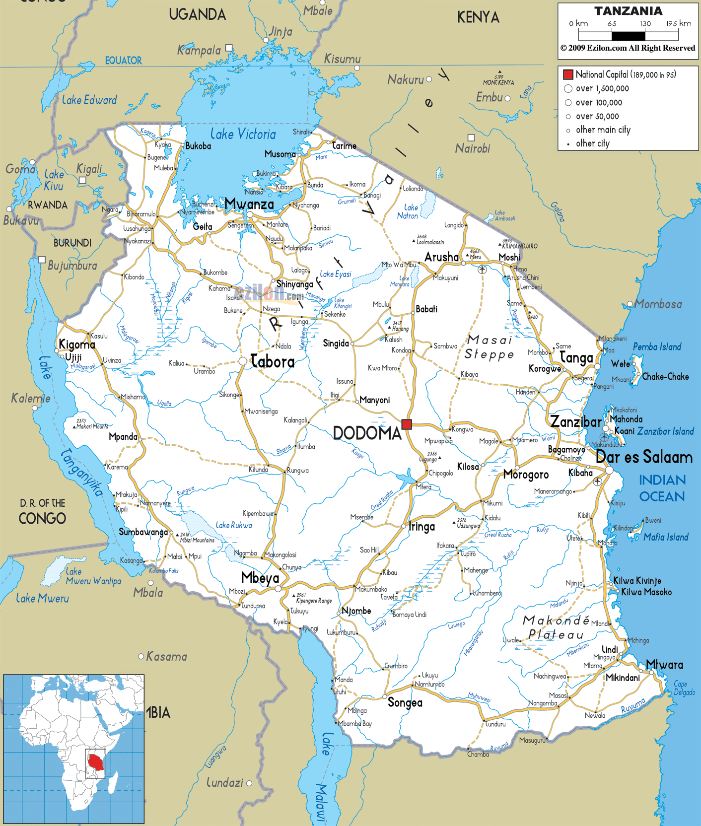
Description: Detailed clear large road map of Tanzania with road routes from cities to towns, road intersections to provinces and perfectures.
 Tanzania
is a sovereign nation in Africa and it is also referred
to as the United Republic of Tanzania. The east of this
nation is situated in the Indian Ocean and it has
Rwanda, Congo and Burundi on its west. Tanzania is the
31st largest country in the world with an area of about
945,087 square kilometers. The size of this country is
more or less like the size of Nigeria. The northeastern
part of the country is hilly and Mount Kilimanjaro (the
highest peak in Africa) is located on this part off the
country. Africa's largest lake, Lake Victoria, is found
in Tanzania. The country is also home to Lake
Tanganyika, the deepest lake in the continent and this
lake is very famous for unique fish species.
Tanzania
is a sovereign nation in Africa and it is also referred
to as the United Republic of Tanzania. The east of this
nation is situated in the Indian Ocean and it has
Rwanda, Congo and Burundi on its west. Tanzania is the
31st largest country in the world with an area of about
945,087 square kilometers. The size of this country is
more or less like the size of Nigeria. The northeastern
part of the country is hilly and Mount Kilimanjaro (the
highest peak in Africa) is located on this part off the
country. Africa's largest lake, Lake Victoria, is found
in Tanzania. The country is also home to Lake
Tanganyika, the deepest lake in the continent and this
lake is very famous for unique fish species.
The people from Tanzania are called Tanzanians.

Physical Map of Tanzania
Physical map and map image of Tanzania.

Political Map of Tanzania
Political map and map image of Tanzania.

Regional Directory of United States of America
Information and guide about United States of America and websites with American topics.

Regional Directory of Europe
Information and guide about Europe and websites with European topics.

Regional Directory of Australia
Information and guide about Australia and websites with Australian topics.