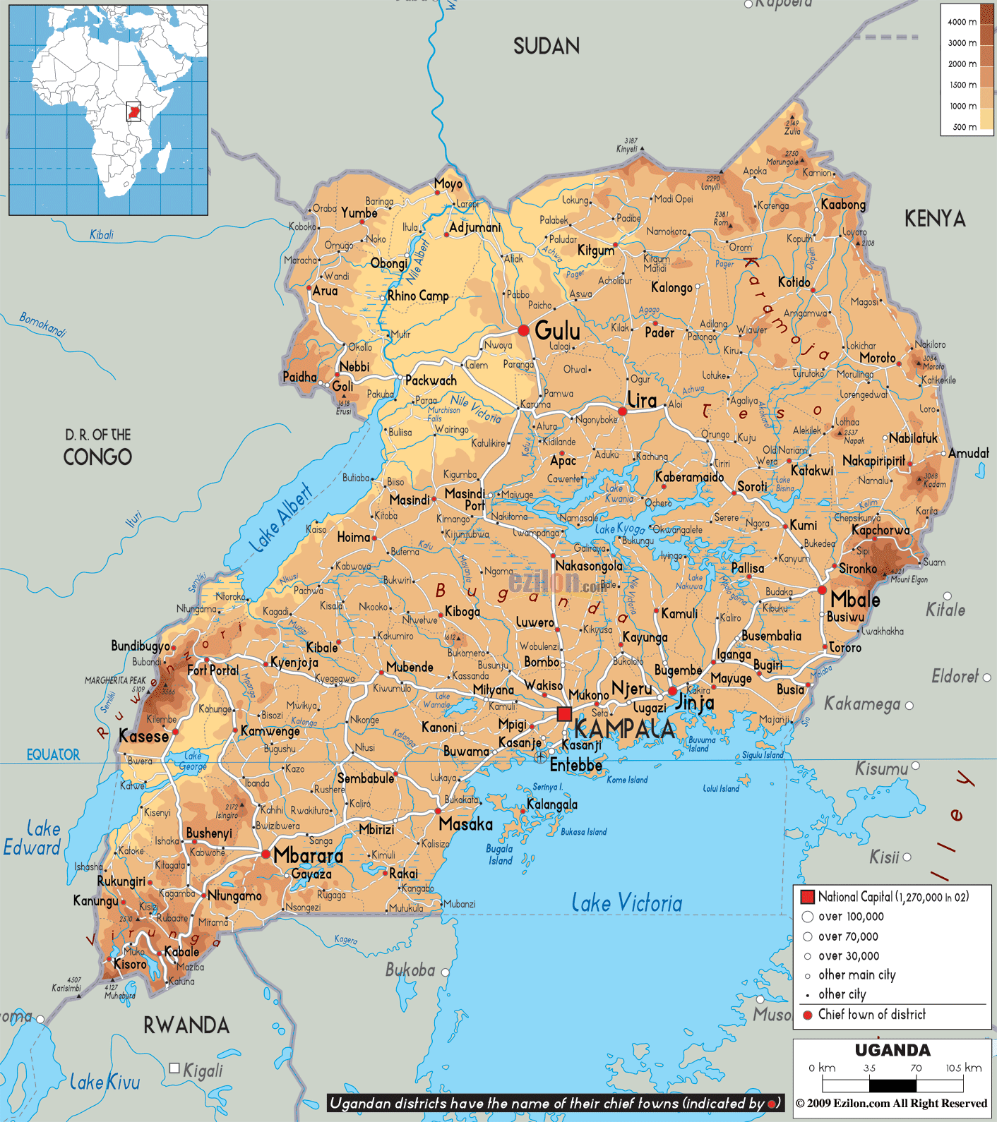
Description: The Physical Map of Uganda showing major geographical features like elevations, mountain ranges, deserts, lakes, plateaus, peninsulas, rivers, plains, landforms and other topographic features.
This map of Uganda with mountains, hills, lakes, rivers and other terrains is already large enough to read directly on your desktop. To see a full-screen zoom view on a phone or tablet, tap the map image (or tap the Zoom Map label above the image). Scan by shading districts in various colored blocks, with Uganda's mountains, hills, lakes and rivers in bold.
 Detailed Physical map of Uganda showing highlands, Lake Victoria, plateaus and other topographic features. Uganda shares its borders with Kenya, Tanzania, Rwanda and the Democratic Republic of the Congo.
The southern part of the nation includes a huge part of
the Lake Victoria which is shared with the countries of
Kenya and Tanzania. Uganda lies within the Nile basin as
well as Africa's Great Lakes region.
The River Victoria Nile drains from Lake Victoria and
falls into Lake Kyoga. A small area in the eastern edge
of Uganda is drained by the River Turkwel and is also a
part of the basin of the Lake Turkana. Although it is a
landlocked country, Uganda contains many more large
lakes apart from the Lake Victoria and the Lake Kyoga,
namely the Lake Albert, the Lake Edward as well as the
smaller Lake George.

Political Map of Uganda
Political map and map image of Uganda.

Road Map of Uganda
Road map and map image of Uganda.

Regional Directory of United States of America
Information and guide about United States of America and websites with American topics.

Regional Directory of Europe
Information and guide about Europe and websites with European topics.

Regional Directory of Australia
Information and guide about Australia and websites with Australian topics.
