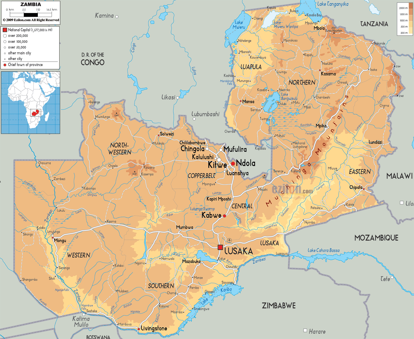
Description: The Physical Map of Zambia showing major geographical features like elevations, mountain ranges, deserts, lakes, plateaus, peninsulas, rivers, plains, landforms and other topographic features.
This map of Zambia with mountains, hills, lakes, rivers and other terrains is already large enough to read directly on your desktop. To see a full-screen zoom view on a phone or tablet, tap the map image (or tap the Zoom Map label above the image). Scan by shading provinces in various colored blocks, with Zambia's mountains, hills, lakes and rivers in bold.
 Detailed Physical map of Zambia showing plateaus, the Zambezi River, Victoria Falls and other topographic features. Zambia shares its borders with Democratic Republic of the Congo, Tanzania, Malawi, Mozambique, Zimbabwe, Botswana, Namibia and Angola.
Zambia consists mostly of very high plateaus along with
mountains which are dissected by river valleys. It
covers an area of about 752,600 km2 and lies between the
latitudes of 8° and 18°S, as well as the longitudes of
22° and 34°E.
There are a number of major rivers flowing in the
Zambezi basin. These include the Kabompo, the
Lungwebungu, the Kafue, the Luangwa as well as the
Zambezi itself.The north of Zambia is very flat with
broad plains. In the west the most notable being the
Barotse Floodplain on the Zambezi, which floods from
December to June, lagging behind the annual rainy season
(typically November to April). Lake Tanganyika is
another major hydrographic feature which belongs to the
Congo basin.

Political Map of Zambia
Political map and map image of Zambia.

Road Map of Zambia
Road map and map image of Zambia.

Regional Directory of United States of America
Information and guide about United States of America and websites with American topics.

Regional Directory of Europe
Information and guide about Europe and websites with European topics.

Regional Directory of Australia
Information and guide about Australia and websites with Australian topics.
