Looking for Regional Information?
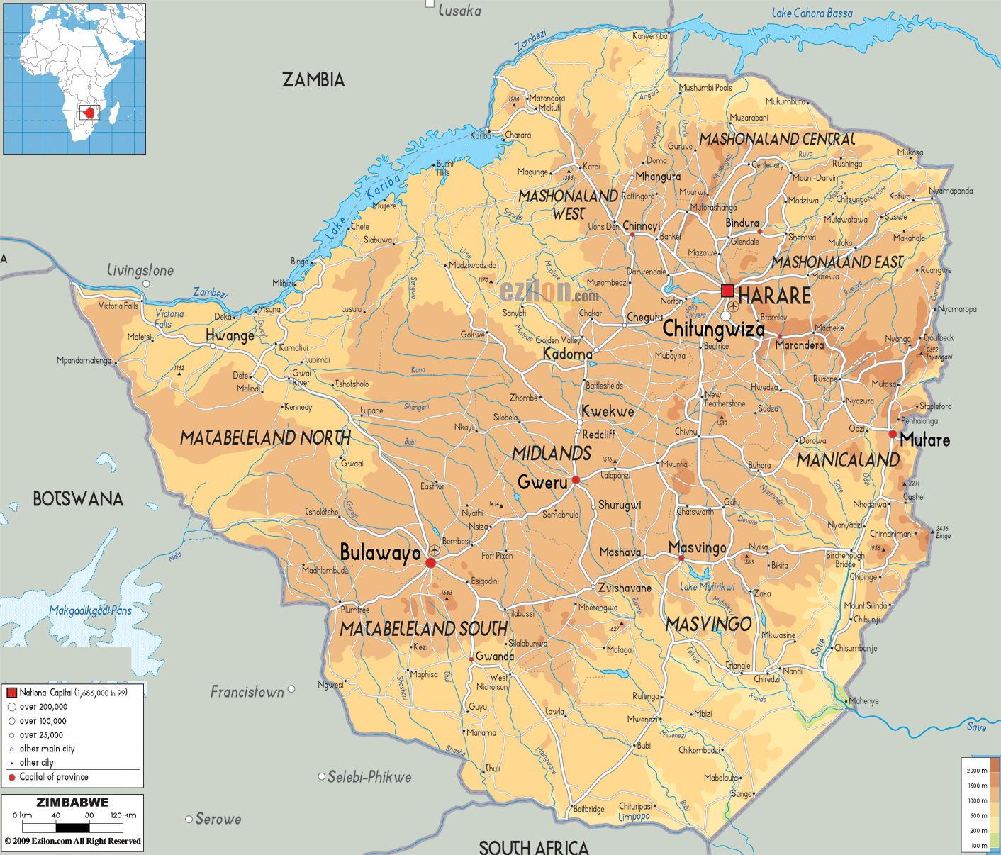
Description: The Physical Map of Zimbabwe showing major geographical features like elevations, mountain ranges, deserts, lakes, plateaus, peninsulas, rivers, plains, landforms and other topographic features.
Zimbabwe Facts and Country Information...
 Zimbabwe is a landlocked country
which is located in the southern Africa and lies between the River
Zambezi as well as the River Limpopo.
Zimbabwe is a landlocked country
which is located in the southern Africa and lies between the River
Zambezi as well as the River Limpopo.
It shares its borderswith South Africa on the south, with Botswana on
the southwest, with Zambia on the northwest and with Mozambique on the
east. Zimbabwe is a landlocked country which lies between the latitudes
of 15° and 23°S, and the longitudes 25° and 34°E.
It has the Victoria Falls which is considered one of the biggest and quite spectacular waterfalls of the world. It is a part of the Zambezi River. The country mostly consists of the savannah, with moist as well as the mountainous regions which are covered with tropical evergreen as well as the hard wood forests.
River Zambezi and Lake Kariba
forms the border with Zambia and Zimbabwe in the North of Zimbabwe.

Political
Map of Zimbabwe
Political map and map image of Zimbabwe.

Road
Map of Zimbabwe
Road map and map image of Zimbawe.

Regional Directory of United States
of America
Information and guide about United States of America and websites with
American topics.

Regional Directory of Europe
Information and guide about Europe and websites with European topics.

Regional Directory of Australia
Information and guide about Australia and websites with Australian
topics.