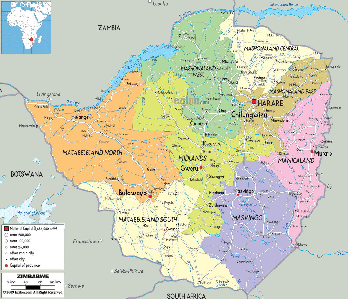
Description: Detailed large political map of Zimbabwe showing names of capital cities, towns, states, provinces and boundaries of neighbouring countries.
This map of Zimbabwe with cities, provinces, and towns is already large enough to read directly on your desktop. To see a full-screen zoom view on a phone or tablet, tap the map image (or tap the Zoom Map label above the image). Scan by shading provinces in various colored blocks, with Zimbabwe's cities and towns in bold.
 Detailed map of Zimbabwe with cities, towns, provinces, villages and surrounding countries. Zimbabwe shares its borders with Zambia, Mozambique, South Africa and Botswana. There are three
official languages in the country and they are English,
Ndebele and Shona. There are about twelve million people
living in Zimbabwe and the country has the lowest life
expectancy in the world.
Detailed map of Zimbabwe with cities, towns, provinces, villages and surrounding countries. Zimbabwe shares its borders with Zambia, Mozambique, South Africa and Botswana. There are three
official languages in the country and they are English,
Ndebele and Shona. There are about twelve million people
living in Zimbabwe and the country has the lowest life
expectancy in the world.
The people from Zimbabwe are called Zimbabweans.

Physical Map of Zimbabwe
Physical map and map image of Zimbabwe.

Road Map of Zimbabwe
Road map and map image of Zimbawe.

Regional Directory of United States of America
Information and guide about United States of America and websites with American topics.

Regional Directory of Europe
Information and guide about Europe and websites with European topics.

Regional Directory of Australia
Information and guide about Australia and websites with Australian topics.