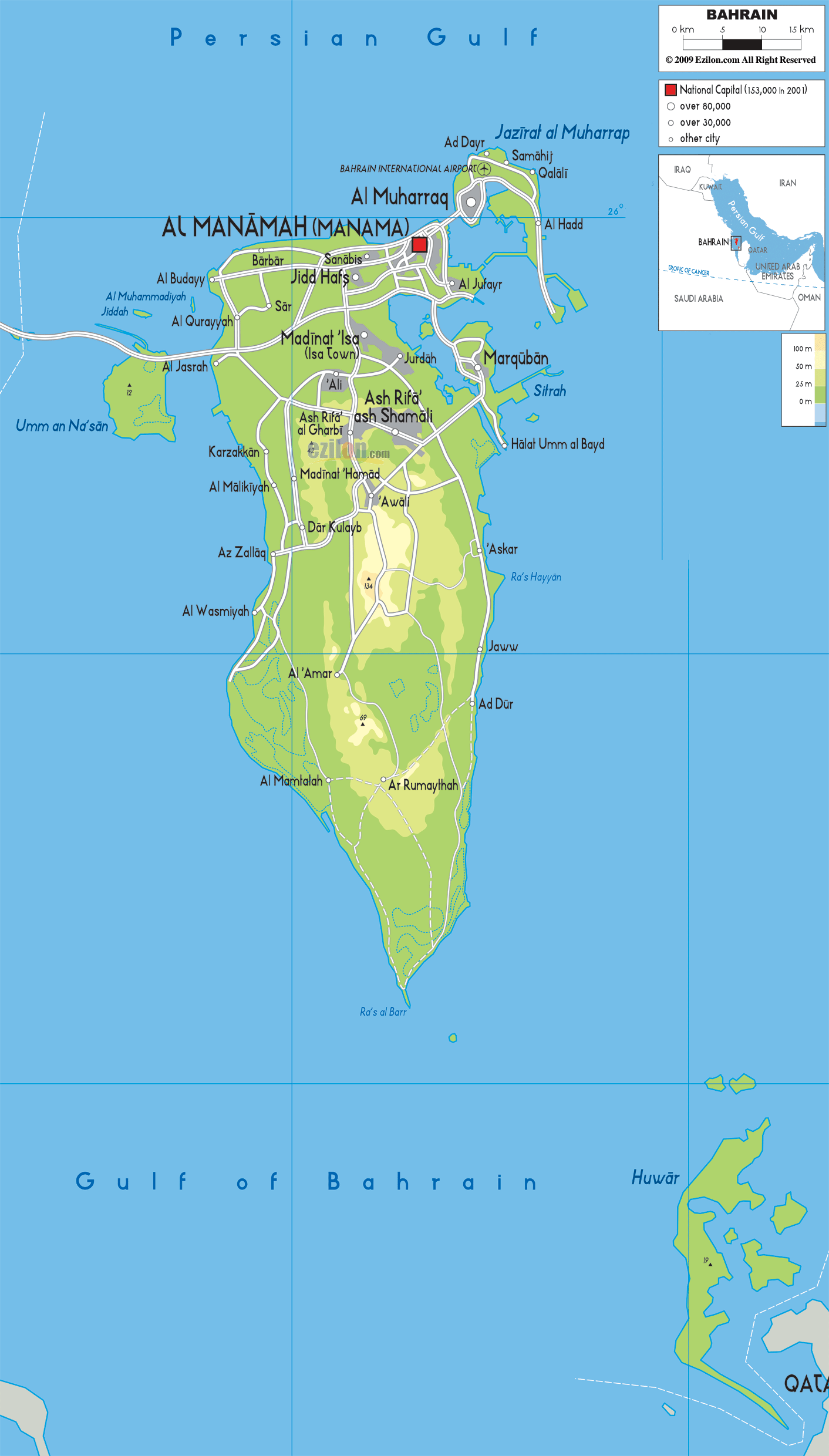
Description: The Physical Map of Bahrain showing major geographical features like elevations, mountain ranges, seas, lakes, plateaus, peninsulas, rivers, plains, landforms and other topographic features.
This map of Bahrain with mountains, hills, lakes, rivers and other terrains is already large enough to read directly on your desktop. To see a full-screen zoom view on a phone or tablet, tap the map image (or tap the Zoom Map label above the image). Scan by shading governorates in various colored blocks, with Bahrain's mountains, hills, lakes and rivers in bold.
 Detailed Physical map of Bahrain showing flat desert and coastline, elevations and other topographic features. Bahrain is an island nation with no land borders, lying near Saudi Arabia and Qatar across the Gulf. Bahrain
with the official name as the Kingdom of Bahrain,
located on the Persian Gulf’s western shores is a small
island. The largest land mass of this archipelago stood
at 55 km long by 18 km wide. Iran lies 200 km to the
north across the Persian Gulf while Saudi Arabia lies to
the west.
Detailed Physical map of Bahrain showing flat desert and coastline, elevations and other topographic features. Bahrain is an island nation with no land borders, lying near Saudi Arabia and Qatar across the Gulf. Bahrain
with the official name as the Kingdom of Bahrain,
located on the Persian Gulf’s western shores is a small
island. The largest land mass of this archipelago stood
at 55 km long by 18 km wide. Iran lies 200 km to the
north across the Persian Gulf while Saudi Arabia lies to
the west.
It is generally flat with the highest point the 134 m
Mountain of Smoke (Jabal ad Dukhan). With total area of
665 km2, it is an arid archipelago of 33 islands,
originally. But due to land reclamation, the number of
islands has now increased to 84 and area has increased
to around 780 Km2. It is the site for the ancient Dimlun
civilization.
It is a desert country with 90 percent area under desert
with periodic droughts and dust storms. Only 3 percentof
the total area of Bahrain is arable. More than 330
species of birds are found in Bahrain.

Physical Map of Bahrain
Physical map and map image of Bahrain.

Road Map of Bahrain
Road map and map image of Bahrain.

Regional Directory of United States of America
Information and guide about United States of America and websites with American topics.

Regional Directory of Europe
Information and guide about Europe and websites with European topics.

Regional Directory of Australia
Information and guide about Australia and websites with Australian topics.