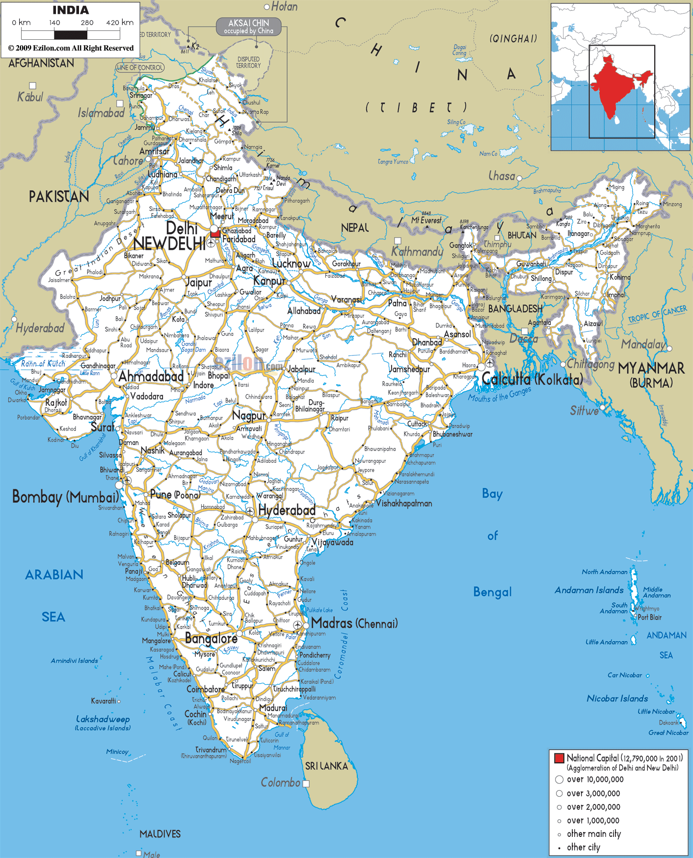
Description: Detailed clear large road map of India with road routes from cities to towns, road intersections to provinces and perfectures.
This map of India with highways, expressways, and roads is already large enough to read directly on your desktop. To see a full-screen zoom view on a phone or tablet, tap the map image (or tap the Zoom Map label above the image). Scan by shading states in various colored blocks, with India's highways and expressways in bold.
 Detailed map of India with Road Map of India with Highways and Expressways for travel and navigation. India's extensive road network connects with neighboring Pakistan, China, Nepal, Bhutan, Bangladesh, and Myanmar.
Sri Lanka is on the southern tip and the Maldives are
off the southwest coast of India. Goa and Kerala are
also other beautiful islands offering wide beaches of
fine golden sand lined with palm trees.
Inland, the Himalayan mountain range in the north, the
Ganges River and the Indus River are magnificent
examples of Nature’s beauty, they also form a natural
barrier between India and the bordering countries.
Most of the population speaks Hindi as well as English;
several other regional languages are also spoken
throughout the country. New Delhi is the capital with
its winding streets, bazaars and modern buildings,
offering a blend of the past and the future.
India counts an infinite number of majestic palaces,
temples and monuments, the famous Golden Triangle is one
of the favorite routes, this comprises Delhi, Agra with
its famous Taj Mahal and Jaipur known as the Pink City.
The holy city of Varanasi and the mystic temples of
Tamil Nadu are also favorite sites, while Bombay and
Calcutta offer a charming colorful and at times hectic
side of India.
The Himalayas boast pristine mountains, beautiful pine
forests; streams and peaceful landscapes, where trekkers
and nature lovers love to explore the heights.
The climate is generally hot all over India, though it
varies depending on the regions. The coolest weather is
from December to February, while the Monsoons are from
June to October.

Physical Map of India
Physical map and map image of India.

Political Map of India
Political map and map image of India.

Regional Directory of United States of America
Information and guide about United States of America and websites with American topics.

Regional Directory of Europe
Information and guide about Europe and websites with European topics.

Regional Directory of Australia
Information and guide about Australia and websites with Australian topics.
