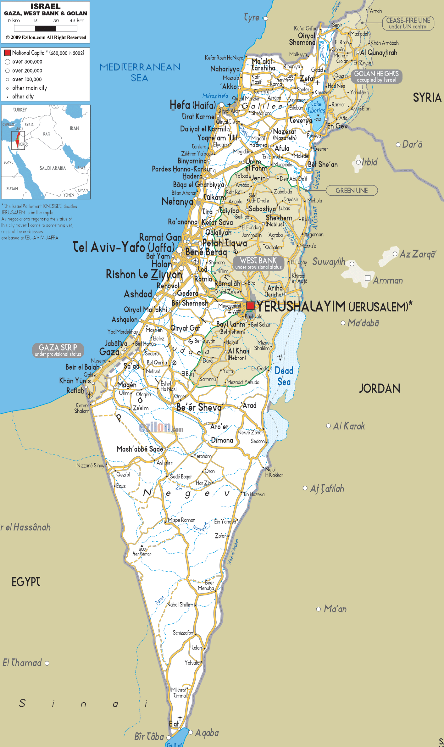
Description: Detailed clear large road map of Israel with road routes from cities to towns, road intersections to provinces and perfectures.
This map of Israel with highways, expressways, and roads is already large enough to read directly on your desktop. To see a full-screen zoom view on a phone or tablet, tap the map image (or tap the Zoom Map label above the image). Scan by shading districts in various colored blocks, with Israel's highways and expressways in bold.
 Detailed map of Israel with Road Map of Israel with Highways and Expressways connecting Jerusalem and Tel Aviv with cities and towns across the country's districts. This ‘Holy Land’ situated in the Eastern Mediterranean shares its borders with Lebanon, Syria, and Jordan, as well as Egypt and the Gaza Strip. Jerusalem is its capital and worldwide center of religion, though the UN does not recognize it as so, claiming it to be Tel Aviv. Hebrew and Arabic are the official languages, although many other languages are spoken throughout the country, including English, French, German, Hungarian, Polish, Romanian, Russian, Spanish and Yiddish.
Israel is small in size but has a varied landscape from
the fertile hills in Galilee with Mount Hermon and Golan
to the Negev Desert and Eliat on the Red Sea. The Great
Rift Valley goes from the River Jordan sources to the
Dead Sea; this is the lowest point in the world, then
onto the Red Sea and Kinneret (Sea of Galilee), which is
in fact Israel’s biggest freshwater lake.

Physical Map of Israel
Physical map and map image of Israel.

Political Map of Israel
Political map and map image of Israel.

Regional Directory of United States of America
Information and guide about United States of America and websites with American topics.

Regional Directory of Europe
Information and guide about Europe and websites with European topics.

Regional Directory of Australia
Information and guide about Australia and websites with Australian topics.
