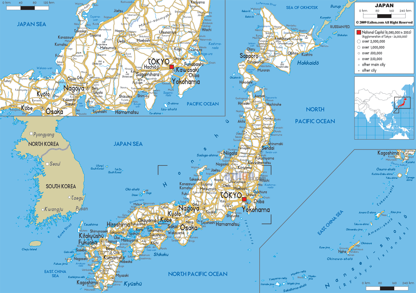
Description: Detailed clear large road map of Japan with road routes from cities to towns, road intersections to provinces and perfectures.
This map of Japan with highways, expressways, and roads is already large enough to read directly on your desktop. To see a full-screen zoom view on a phone or tablet, tap the map image (or tap the Zoom Map label above the image). Scan by shading prefectures in various colored blocks, with Japan's highways and expressways in bold.
 Detailed map of Japan with Road Map of Japan with Highways and Expressways connecting Tokyo with cities and towns across its prefectures. Japan is an island nation with no land borders, but lies across the sea from South Korea, North Korea, China, and Taiwan. Situated in the Far East, the archipelago of Japan is separated from the Asian mainland by the sea and split into four main islands: Honshu, Hokkaido, Kyushu and Shikoku. The capital is Tokyo and the official language Japanese.
Most of the country is covered with hills and mountains,
a few of which are still active or dormant volcanoes,
notably Mount Fuji the highest in the country rising to
3,776 m above sea level. The costal line is very long
and varied, with deeply indented bays and natural
harbors with the backdrop of mountains. Japan is
composed of thousands of islands of magnificent natural
beauty, with the lavender farms of the isle of Hokkaido
in the north and the subtropical beaches of Okinawa in
the south.

Physical Map of Japan
Physical map and map image of Japan.

Political Map of Japan
Political map and map image of Japan.

Regional Directory of United States of America
Information and guide about United States of America and websites with American topics.

Regional Directory of Europe
Information and guide about Europe and websites with European topics.

Regional Directory of Australia
Information and guide about Australia and websites with Australian topics.
