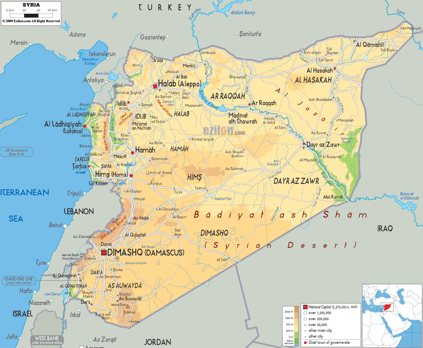
This map of Syria with mountains, hills, lakes, rivers and other terrains is already large enough to read directly on your desktop. To see a full-screen zoom view on a phone or tablet, tap the map image (or tap the Zoom Map label above the image). Scan by shading governorates in various colored blocks, with Syria's mountains, hills, lakes and rivers in bold.
 Syria
officially known as the Syrian Arab Republic, is a
country in West Asia, have borders Turkey to the
north,Lebanon and the Mediterranean Sea to the west,
Iraq to the east, Israel to the southwest and Jordan to
the south.
Syria
officially known as the Syrian Arab Republic, is a
country in West Asia, have borders Turkey to the
north,Lebanon and the Mediterranean Sea to the west,
Iraq to the east, Israel to the southwest and Jordan to
the south.
Arid plateau is the main topographical feature of the
country. In the northwest the country is fairly green.
The greener side of the country is bordering the
Mediterranean. "Al Jazira" in the north and "Hawran" in
the south are the main agricultural lands of Syria.
he main oil fields are Qaratshui, Tayyem, near Dayraz–Zawr,
Rumayian and Suwaydiyah. These fields are the extension
of the oil fields of Mosul and Kirkuk of Iraq. At the
field of Jbessa natural gas was found in 1940. At some
parts of the country the elevation reaches to a point
where the snowfall happens during winter season. Syria
is among one of the fifteen states that constitutes the
part of the Cradle of civilization.

Political Map of Syria
Political map and map image of Syria.

Road Map of Syria
Road map and map image of Syria.

Regional Directory of United States of America
Information and guide about United States of America and websites with American topics.

Regional Directory of Europe
Information and guide about Europe and websites with European topics.

Regional Directory of Australia
Information and guide about Australia and websites with Australian topics.