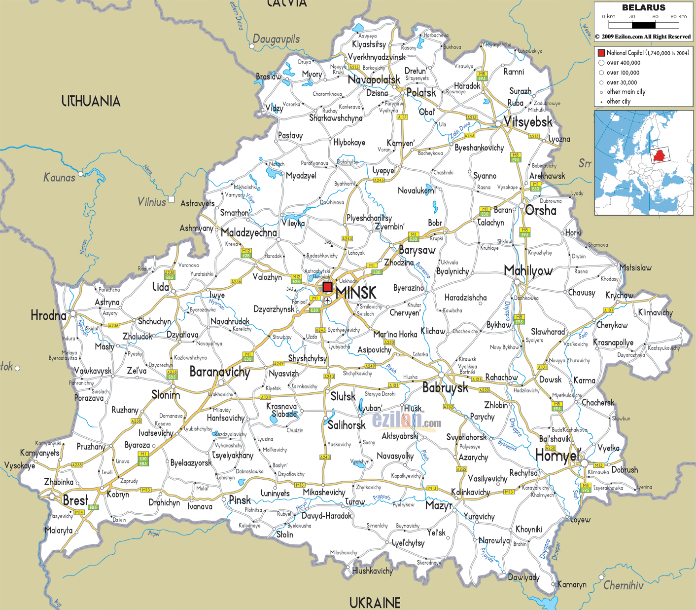
Description: Detailed clear large road map of Belarus with road routes from cities to towns, road intersections to provinces and perfectures.
 Belarus have extensive road and highway network which covers almost all cities, towns and villages.
A117 highway starts from the neighboring country in the North, and pass through Klyastsitsy, Navapolatsk, with intersection at Polatsk, then continues southward and terminates at Lyepyel. A245 continues from Lyepyel, crossing over Plyeshchanitsy, lahaysk to the capital city of Minsk in the central part of the country.
M1-E30 connects Minsk in the center with Barysaw, Talachyn and Arekhawsk in the border town in the north East, while also extend southwards by passing Dzyarzhynsk, Kobryn to the Southern border town of Malaryta, making this highway the longest in the country.
Also, there are roads for anyone travelling from towns such as Hrodna, crossing through Schchuchyn, Lida to Minsk and beyond.

Political Map of Belarus
Political map and map image of Belarus.

Physical Map of Belarus
Physical map and map image of Belarus.

Regional Directory of United States of America
Information and guide about United States of America and websites with American topics.

Regional Directory of Europe
Information and guide about Europe and websites with European topics.

Regional Directory of Australia
Information and guide about Australia and websites with Australian topics.