Description: The physical map of Denmark showing major geographical features like elevations, seas, lakes, plateaus, peninsulas, rivers, plains, landforms and other topographic features.
 Denmark
is a country located in the northern part of Europe with
a few islands in the Baltic Sea known as the Danish
Archipelago. Denmark is situated to the southwest of
Sweden, due south of Norway and north of Germany.
Germany provides the only land border for the country
which stretches across 68 kilometers. The country also
separates the North and Baltic Seas.
Denmark
is a country located in the northern part of Europe with
a few islands in the Baltic Sea known as the Danish
Archipelago. Denmark is situated to the southwest of
Sweden, due south of Norway and north of Germany.
Germany provides the only land border for the country
which stretches across 68 kilometers. The country also
separates the North and Baltic Seas.
The country is dominated by low lying areas excluding the slightly higher Jutland Peninsula. Mollehoj stands tall at 170 meters and is the highest point in the entire country and is marginally taller than the second highest peak called YdingSkovhoj.
The country is drained by more than 10 rivers and the most important ones are Odense, Guden, Susa, Stora, Vida and Skjern. Vida is the river which flows along the Danish and German border. Guden is the longest river with a length of 160 kilometers.
The Jutland Peninsula along with 140 other named islands form the entire country of Denmark. The Jutland Peninsula also has a few rivers. The Karup River sits in the northern region flowing towards the southeast; the Varde River runs from the west coast towards the eastern shore and so does the Fladsa River.

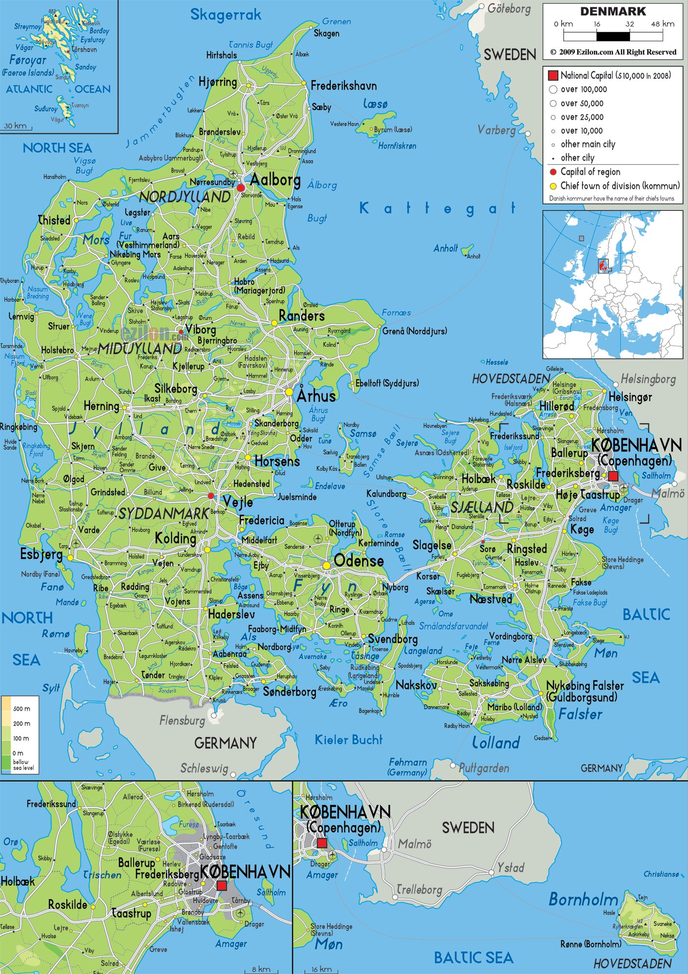
Political Map of Denmark
Political map and map image of Denmark.

Road Map of Denmark
Road map and map image of Denmark.

Regional Directory of United States of America
Information and guide about United States of America and websites with American topics.

Regional Directory of Europe
Information and guide about Europe and websites with European topics.

Regional Directory of Australia
Information and guide about Australia and websites with Australian topics.