Description: Detailed clear large road map of Denmark with road routes from cities to towns, road intersections to provinces and perfectures.
This map of Denmark with highways, expressways, and roads is already large enough to read directly on your desktop. To see a full-screen zoom view on a phone or tablet, tap the map image (or tap the Zoom Map label above the image). Scan by shading regions in various colored blocks, with Denmark's highways and expressways in bold.
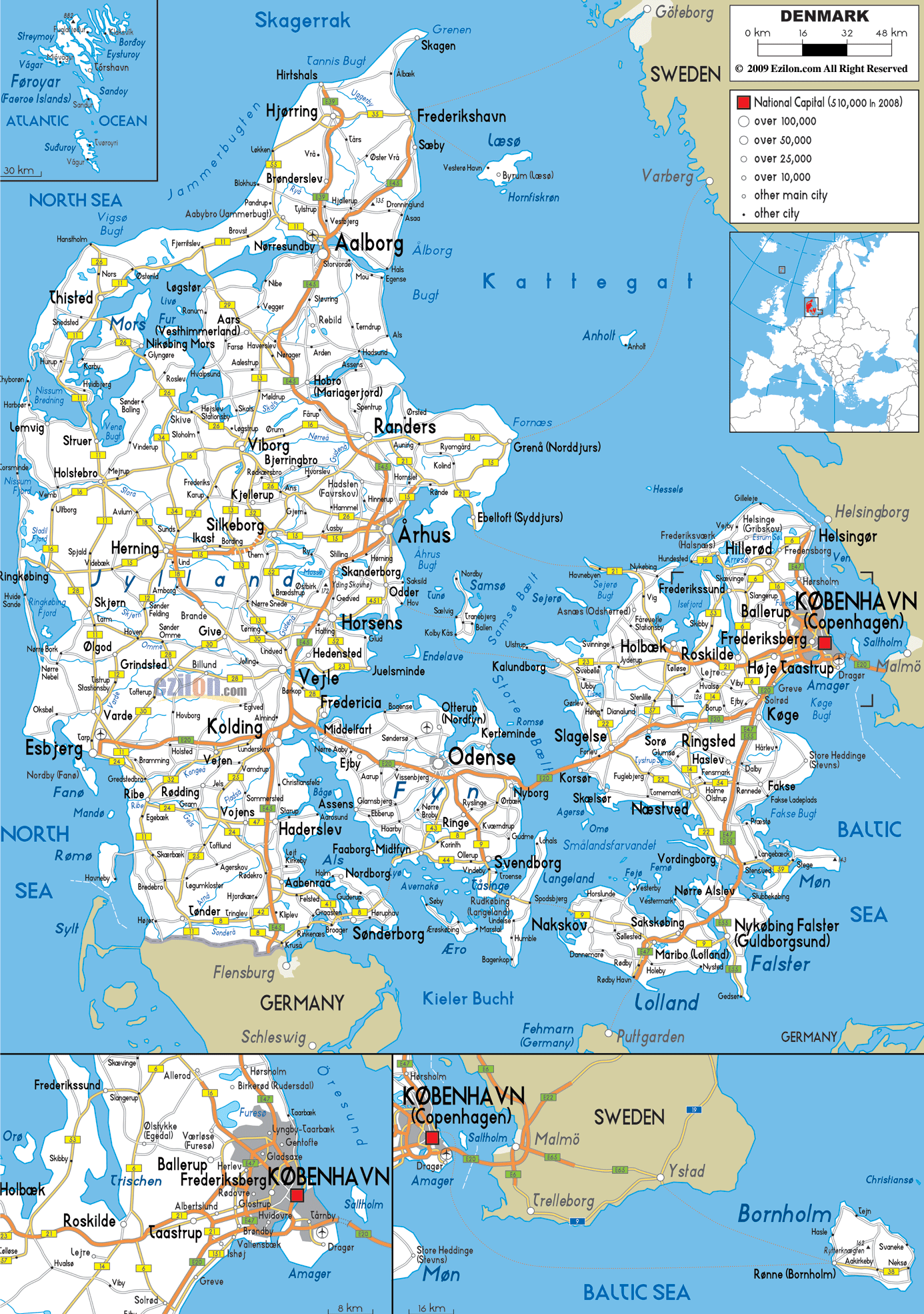
 Denmark motorways connecting Jutland, Funen, Zealand and Lolland-Falster are developed by the state owned company The Danish Road Directorate, the motorways connects also to various cities and towns all over the country.
The 2 longest motorways are E45 and E20 motorways connecting almost the entire country in the North, South, East and West. Motorways are toll-free with exception of the Great Belt Bridge joining Zealand and Funen and the Øresund Bridge linking Copenhagen to Malmö in Sweden.
E45 starts from Frederikshavnmotorvejen, passing through Aalborg to Aarhus then to Kolding, Haderslev and moving down all the way into neighbouring country Germany.
E20 connects Copenhagen in the East with Soro, Nyborg, Middlefart, to Kolding and stopped over in the west at Esbjerg.
11 road connects Thistedgrenen (Nørresundby – Høvejen), E55 Helsingørmotorvejen (Copenhagen - Helsingør), other roads are 21 Holbækmotorvejen (Copenhagen - Holbæk), Kalundborgmotorvejen (Elverdam - Nørre Jernløse).

Physical Map of Denmark
Physical map and map image of Denmark.

Political Map of Denmark
Political map and map image of Denmark.

Regional Directory of United States of America
Information and guide about United States of America and websites with American topics.

Regional Directory of Europe
Information and guide about Europe and websites with European topics.

Regional Directory of Australia
Information and guide about Australia and websites with Australian topics.