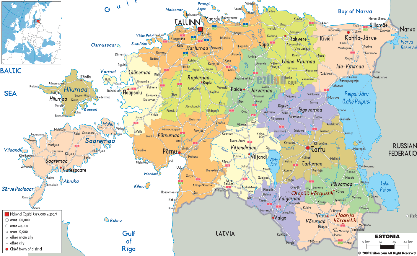

Description: Detailed large political map of Estonia showing names of capital cities, towns, states, provinces and boundaries with neighbouring countries.
 Situated
in Northern Europe Estonia is the most northerly and
scenic of the three Baltic Republics, with the Russian
Federation to the east and Latavia to the south. Facing
the Baltic Sea this country boasts more coastline
landscapes than Latavia and Lituana, as well as
magnificent forests, more than 1,500 islands and 1,400
lakes.
The official language is Estonian, although the older
people speak Russian, while the younger generation
speaks English. The capital is the splendid medieval
Tallinn with many examples of majestic architecture,
encircled by primeval forests and lake lands.

Physical Map of Estonia
Physical map and map image of Estonia.

Road Map of Estonia
Road map and map image of Estonia.

Regional Directory of United States of America
Information and guide about United States of America and websites with American topics.

Regional Directory of Europe
Information and guide about Europe and websites with European topics.

Regional Directory of Australia
Information and guide about Australia and websites with Australian topics.