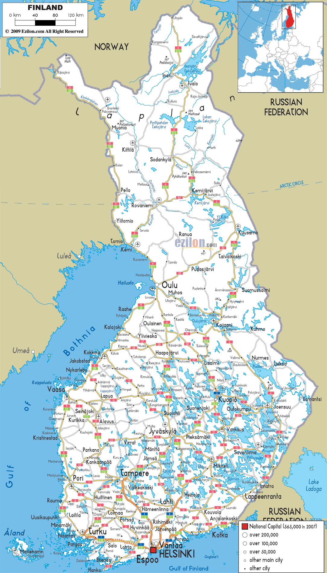
Description: Detailed clear large map of Finland with road routes from cities to towns, road intersections in regions, provinces, prefectures, also with routes leading to neighboring countries.
This map of Finland with highways, expressways, and roads is already large enough to read directly on your desktop. To see a full-screen zoom view on a phone or tablet, tap the map image (or tap the Zoom Map label above the image). Scan by shading regions in various colored blocks, with Finland's highways and expressways in bold.
 Detailed map of Finland with Road Map of Finland with Highways and Expressways connecting cities, towns and regions across the country. Finland main road network are very vast and it is the most important method of transportation for transporting goods, services and people around the country.
The longest one stretches from Ulsjoki in the north, passing Inari, Ivalo, Sodankylä, Rovaniemi, Kemi, to Oulu, Jyväskylä, Heinola, Lahti, Järvenpää and ends finally at Helsinki and Espoo in the south. There is no toll road in Finland at the moment.
E63 is another long main road starting at Sadankylä then to Kemijärvi, Kuusamo, Kajaani, Lisalmi, Kuopio, still stretching to Suonenjoki, Jyväskylä, Jämsä to Tampere and then ends up to Turku.
The world's northernmost motorway is also located in Finland between Keminmaa and Tornio (Main road 29/E8). There are other main road networks in Finland which are useful when travelling, can be seen at the above map .

Physical Map of Finland
Physical map and map image of Finland.

Political Map of Finland
Political map and map image of Finland.

Regional Directory of United States of America
Information and guide about United States of America and websites with American topics.

Regional Directory of Europe
Information and guide about Europe and websites with European topics.

Regional Directory of Australia
Information and guide about Australia and websites with Australian topics.