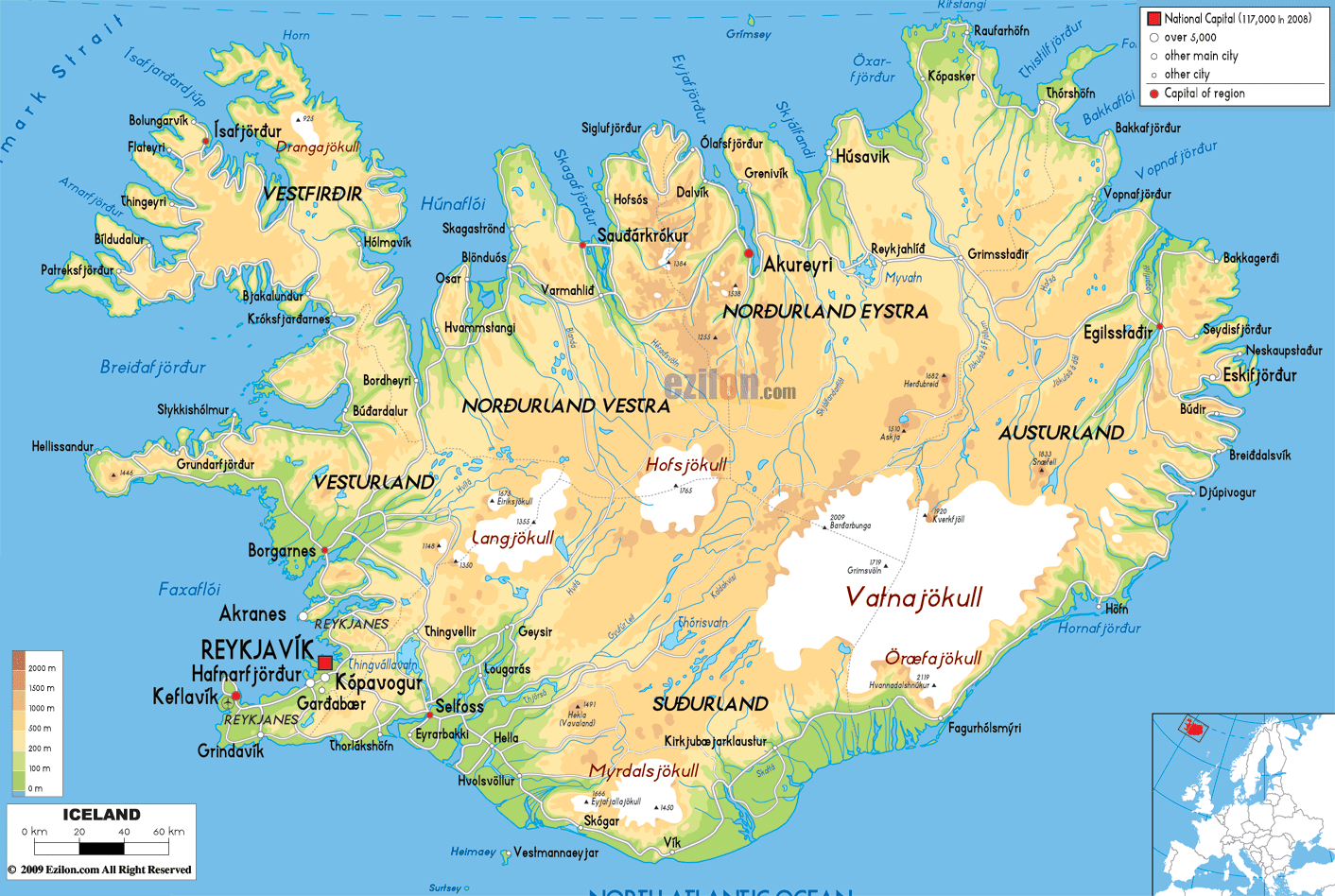
Description: The physical map of Iceland showing major geographical features like elevations, mountain ranges, seas, lakes, plateaus, peninsulas, rivers, plains, landforms and other topographic features.
 Iceland
is an island country and is located at the meeting point
of the North Atlantic and Arctic Oceans. The country is
located just south of the Arctic Circle and east of
Greenland.
Iceland
is an island country and is located at the meeting point
of the North Atlantic and Arctic Oceans. The country is
located just south of the Arctic Circle and east of
Greenland.
The country covers an area of 103001 square kilometers,
making it the 18th largest chunk of land on Earth. The
country does not share any land borders. It is 4200
kilometers away from New York City and 860 kilometers
away from Scotland.
Most of the country is full of volcanic mountains and
glaciers. The three most dominant glaciers are
Vatnajokull, Hofsjokull and Langjokull. Vatnajokull is
the largest with a staggering surface area of 8300
square kilometers.
The highest mountain in the country is 2110 meters high
and is called Hvannadalshnukur whereas the lowest point
lies 146 meters beneath the surface of the Atlantic
Ocean. The area is highly active as far as volcanoes are
concerned and the most active ones are Eldgja, Hekla,
Eldfell and Heroubreio.
The country also has a few lakes out of which the
Porisvatn is the largest with a volume of 3300
gigalitres and an area of 83-88 square kilometers. The
country also has a few important lakes like the Hvita,
Krossa, Blanda and Jokulsa a Dal.

Political Map of Iceland
Political map and map image of Iceland.

Road Map of Iceland
Road map and map image of Iceland.

Regional Directory of United States of America
Information and guide about United States of America and websites with American topics.

Regional Directory of Europe
Information and guide about Europe and websites with European topics.

Regional Directory of Australia
Information and guide about Australia and websites with Australian topics.