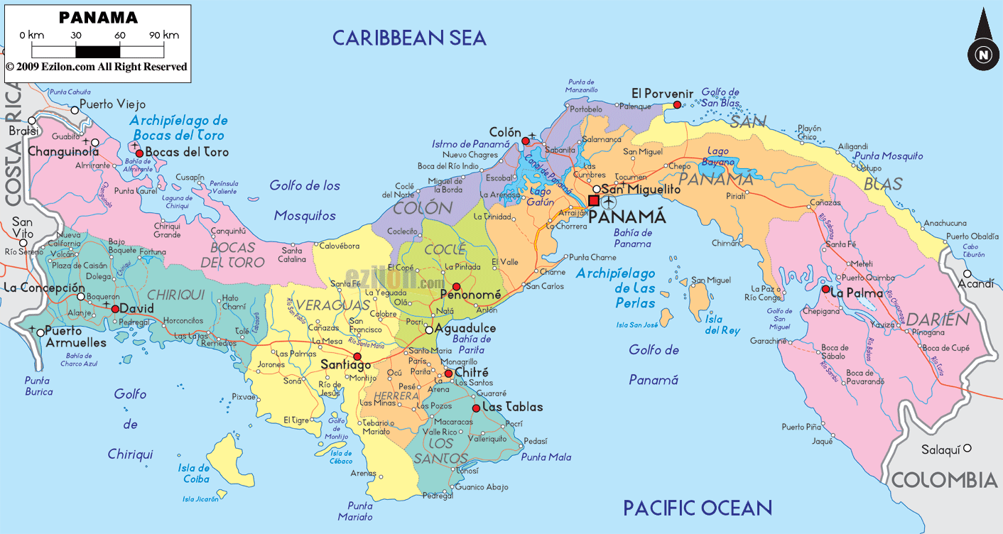
Description: Detailed large political map of Panama showing names of capital city, towns, states, provinces and boundaries with neighbouring countries.
 Panama
is a country that is located in Central America. It
basically lies on the isthmus that connects the southern
America and the Northern America. It has the pacific
ocean on its south and the Caribbean Sea on is north.
Panama
is a country that is located in Central America. It
basically lies on the isthmus that connects the southern
America and the Northern America. It has the pacific
ocean on its south and the Caribbean Sea on is north.
Panama City is the capital of this country. It is the 4th largest economy in the Central America but it is still growing at a very fast rate. Panama is also the largest per capita consumer in the Central America and it is considered as an international business center.
The temperature is high in Panama and the humidity level is also quite high. Its culture has been influenced by the European culture and this can be seen in its traditions, arts and music. It has been reported that the country has an unemployment rate of about 5.1% and in the year 2008, it was the second fastest growing Latin American economy.
The growth of the country was
due to the port and shipping activities of the Colon
Free Zone and Panama Canal. Balboa is the official
currency of Panama. Tourism is also an important part of
Panama's economy with about 1,110,000 people visiting
the country in the year 2008, and most of the tourists
were from Europe.

Physical Map of Panama
Physical map and map image of Panama.

Regional Directory of Caribbean
Information and guide about Caribbean and website listing.

Regional Directory of United States of America
Information and guide about United States of America and websites with American topics.

Regional Directory of Europe
Information and guide about Europe and websites with European topics.

Regional Directory of Australia
Information and guide about Australia and websites with Australian topics.