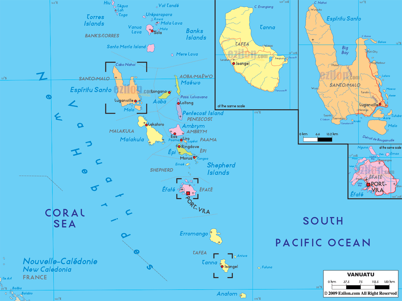
Description: Detailed large political map of Vanuatu showing names of capital city, towns, states, provinces and boundaries with neighbouring countries.
 Vanuatu
is an island nation that lies in the south of the
Pacific Ocean. The Melanesian people were the first
people to live in this island nation and in the late
1700s; the European people start to settle in Vanuatu.
Vanuatu
is an island nation that lies in the south of the
Pacific Ocean. The Melanesian people were the first
people to live in this island nation and in the late
1700s; the European people start to settle in Vanuatu.
The nation was once under the rule of the U.K and France but in the year 1980, the country gained its independence and the Republic of Vanuatu was formed.
The
nation is basically an archipelago that consists of
about eighty-two small islands and of these islands,
only sixty-five of them are inhabited. Port Vila is the
largest town in this island nation and it is also the
capital of Vanuatu.
There are about 221,506 people living in the country and
the number of the male population is more than the
female population. While there are many people living in
the Port Vila and Luganville, most of the population of
the country is living in the rural regions.
Almost all
the people living in this nation are of Melanesian
descent (about 98.5%). The rest of the population of the
country includes Asians, Europeans and Pacific
islanders. French, English and Bislama are the three
official languages of Vanuatu. The Vanuatu people are
mostly Christians.

Physical Map of Vanuatu
Physical map and map image of Vanuatu.

Regional Directory of Australia
Information and guide about Australia and website listing.

Regional Directory of United States of America
Information and guide about United States of America and websites with American topics.

Regional Directory of Europe
Information and guide about Europe and websites with European topics.

Regional Directory of Australia
Information and guide about Australia and websites with Australian topics.