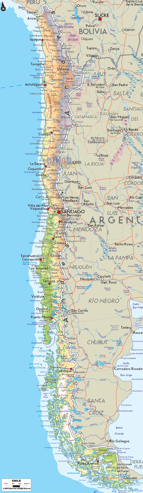
Description: The Physical Map of Chile showing major geographical features like mountain ranges, elevations, ocean, lakes, plateaus, peninsulas, rivers, plains, landforms and other topographic features.
 Chile
is officially known as the Republic of Chile and lies in
the South American continent. It occupies a long, narrow
strip of land between the Mountains of the Andes on the
east and the Pacific Ocean on the west. It shares
borders with Peru on the north and Bolivia on the
northeast. It has Argentina on the east, as well as the
Drake Passage in the far south.
Chile
is officially known as the Republic of Chile and lies in
the South American continent. It occupies a long, narrow
strip of land between the Mountains of the Andes on the
east and the Pacific Ocean on the west. It shares
borders with Peru on the north and Bolivia on the
northeast. It has Argentina on the east, as well as the
Drake Passage in the far south.
The territory of Chile also includes the islands of the
Juan Fernández, the Salas y Gómez, the Desventuradas,
and the Easter Island in the Pacific Ocean. It is in
shape of a long but narrow coastal Cone in the south,
lying to the western side of the Andes Mountains.
Chile stretches for over 4,300 km from north to south
and is only 350 km wide from east to west. Hence it is
prone to many climatic changes and is situated on the
Pacific Ring of Fire which makes it an unstable region
prone to untimely earthquakes.
The Atacama Desert in the north is home to huge mineral
wealth. The Southern parts of Chile comprise of rich,
green forests witha lot of grazing lands, and violent
volcanoes as well as lakes.

Political Map of Chile
Political map and map image of Chile.

Regional Directory of South America
Information and guide about South America and website listing.

Regional Directory of United States of America
Information and guide about United States of America and websites with American topics.

Regional Directory of Europe
Information and guide about Europe and websites with European topics.

Regional Directory of Australia
Information and guide about Australia and websites with Australian topics.