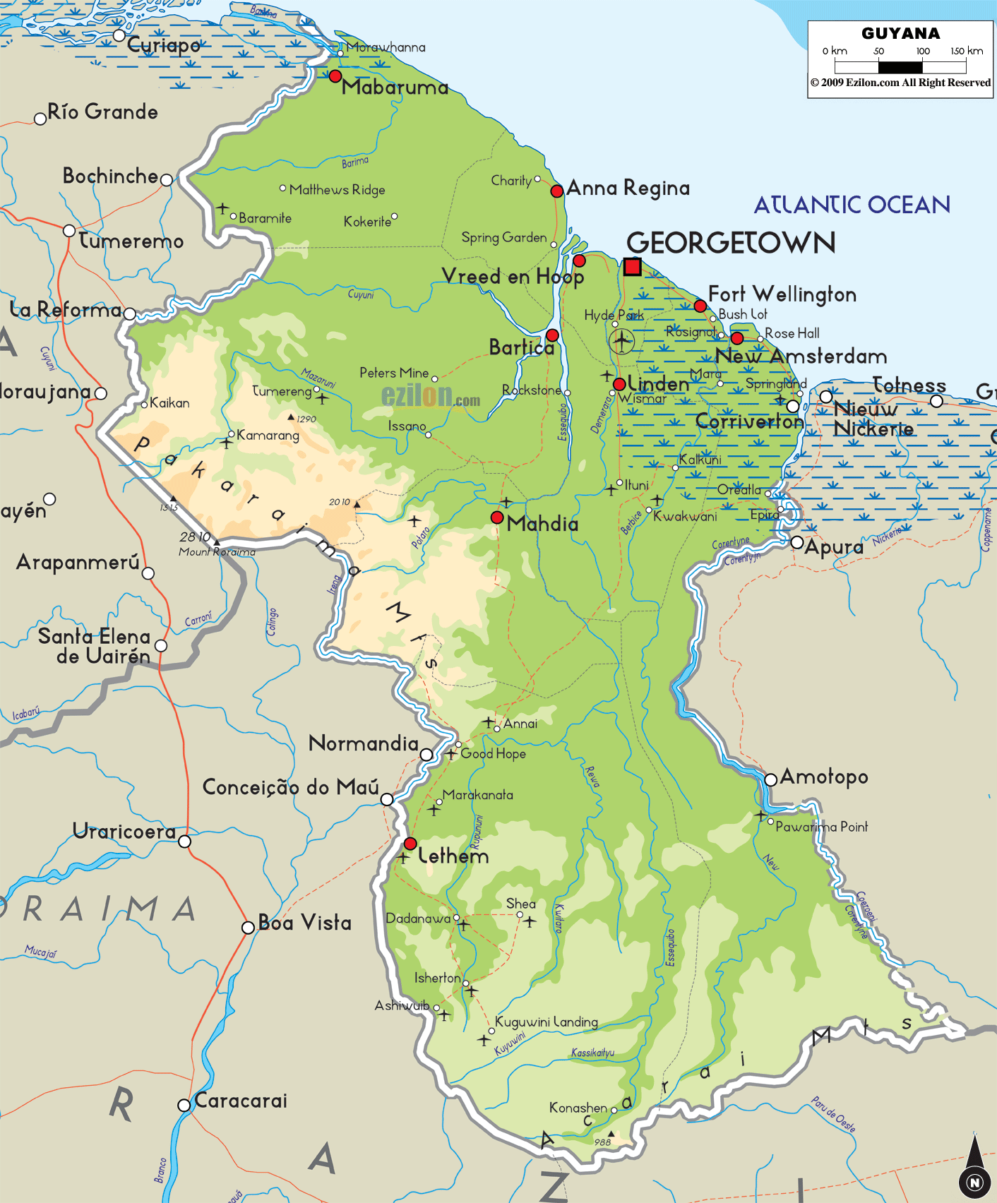
Description: The Physical Map of Guyana showing major geographical features like elevations, mountain ranges, ocean, lakes, plateaus, peninsulas, rivers, plains, landforms and other topographic features.
This map of Guyana with mountains, hills, lakes, rivers and other terrains is already large enough to read directly on your desktop. To see a full-screen zoom view on a phone or tablet, tap the map image (or tap the Zoom Map label above the image). Scan by shading regions in various colored blocks, with Guyana's mountains, hills, lakes and rivers in bold.
 Detailed Physical map of Guyana showing rainforest, rivers and coastal plains, elevations and other topographic features. Guyana is bordered by Venezuela, Brazil and Suriname. Guyana
is officially called the Co-operative Republic of
Guyana. It is a sovereign state which lies on the
northern coast of the continent of South America. Guyana
is mainly a part of the Anglophone Caribbean, and is one
of the few Caribbean countries that does not form an
island.
Detailed Physical map of Guyana showing rainforest, rivers and coastal plains, elevations and other topographic features. Guyana is bordered by Venezuela, Brazil and Suriname. Guyana
is officially called the Co-operative Republic of
Guyana. It is a sovereign state which lies on the
northern coast of the continent of South America. Guyana
is mainly a part of the Anglophone Caribbean, and is one
of the few Caribbean countries that does not form an
island.
The country has been divided into five natural regions;
•Low coastal plain: A narrow and fertile marshy plain
along the Atlantic coast
•Hilly sand and clay region: A white sand belt more
inland which contains most of Guyana's mineral deposits
•Forested Highland Region: the dense rain forests in the
southern part of the country
•Desert Savannah:the desert savannah in the southern
west
•Interior Savannah:the smallest interior lowlands which
mostly consist of mountains that gradually rise to the
Brazilian border.
The highest mountains of Guyana are the Mount Ayanganna
at 2,042 metres, the Monte Caburaí at 1,465 metres and
the Mount Roraima at 2,810 metreswhich supposedly is the
highest mountain in Guyana. It is a part of the
Pakaraima mountain range. The longest rivers of Guyana
are the Essequibo, the Courantyne River, the Berbice,
and the Demerara. There are several large islands at the
mouth of the Essequibo, including Shell Beach which lies
along the north-west coast.

Political Map of Guyana
Political map and map image of Guyana.

Regional Directory of South America
Information and guide about South America and website listing.

Regional Directory of United States of America
Information and guide about United States of America and websites with American topics.

Regional Directory of Europe
Information and guide about Europe and websites with European topics.

Regional Directory of Australia
Information and guide about Australia and websites with Australian topics.
